
| Trail Map | ||
| Distance: 8 km | Time: 3 hours | Difficulty: Moderate - Strenuous |
| Ascent: 295m |
If you would have asked me last year whether I had ever hiked Nahal Katlav, I would have said: of course!
But now I’ve actually followed the Nahal Katlav trail near Nes Harim all the way down and through the valley. And I know that all along, I’ve been missing out on something seriously beautiful right near my home.
You see, Nahal Katlav (the riverbed) is part of Nahal Katlav (the Nature Reserve). There are many trails that lead through this beautiful forested reserve outside of Jerusalem. You could hike for hours from one trail to another without ever actually descending into the riverbed itself.
I had no idea of the dark, rich beauty we would discover down in Nahal Katlav. The trails along the top of the mountain are spectacular, but they get hot on a summer day.

Not so in the riverbed itself, where the moisture from an entire season’s rainfall seems to stick around, yielding thick green shrubbery and trees, along with moss covered rocks.
Here’s what we experienced on our hike through the hidden valley of Nahal Katlav:
The Long Journey Down
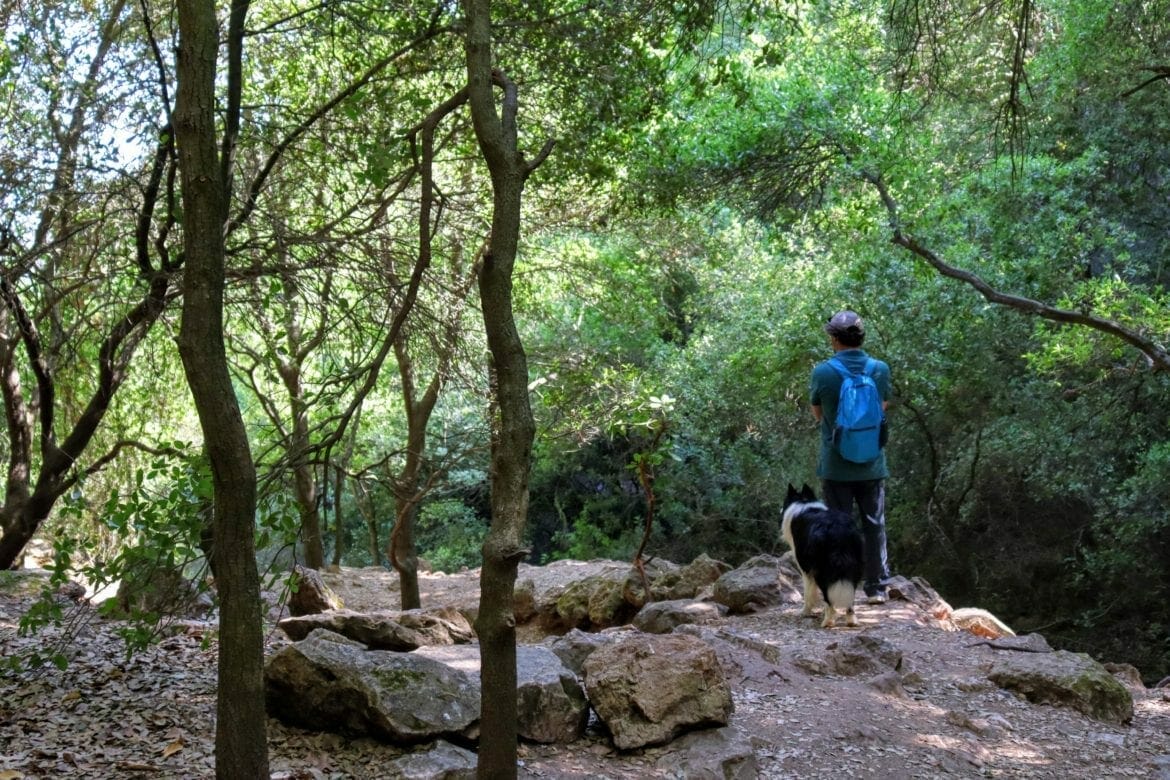
The trail begins right past Bar Behar, same place where we started the Schuster Trail and Nahal Sorek and Beyond. Instead of starting at the café, we continued further down to the end of the parking lot, where the Schuster Trail ends.
From here, we followed the black trail down a long set of stone steps. We then continued to weave our way back and forth, descending all the while along the black trail.

So far, the scenery was familiar. Golden summer grass and dry flowers framed the pathway. The occasional cluster of purple blossoms escaped into the gentle breeze. Bumblebees bounced around from flower to flower. We’d seen this part of the Nahal Katlav trail before.
But we went still further, climbing ever downwards, until the landscape around began to change. In place of gnarly oak trees and yellow wheat, we saw cool rock formations, covered in a thick canopy of shade. We descended into the shadows and found a place to take in the silence on a carpet of leaves.
Already Unexpected
It only took a few minutes for the surroundings to touch my soul. It was quiet down there, and cool – much cooler than it was up top in the summer sun.
Rich red bark of nearby katlav trees contrasted with the deep, soft green of their leaves. The only sound was the buzzing of bees and birds chirping. It felt like we were in a truly peaceful place, where no one could disturb the silence.

I guess I must have known that Nahal Katlav was named for a river that runs through it (after flash floods, it seems). And where there’s a river in Israel, there’s usually smooth rock formations and lots of greenery. But somehow, we’d never made it all the way down to the bottom to explore.
Just Around the River Bend
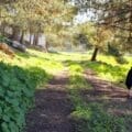
After taking in our surroundings, we continued along the path through the thick shadow of trees, climbing under hanging branches to stay on the black trail. As we followed the riverbed, we came across descents on flat rock, complete with metal handholds. We climbed down easily, further downward to the next level of stone and green.

We walked this way for a long, long time.
Eventually, once the descent was complete, the path became flat, a long, straight walk through the riverbed. Fallen trees made fun spots to climb on.
We walked, and talked, taking in the peacefulness of our surroundings. And before we knew it, we reached the end of the line, where Nahal Katlav runs into the Sorek River at the old train station. From here, we made a left onto a green trail that would take us out of the riverbed again, slow and steady back up the mountain.

The Hardest Part
As opposed to climbing a mountain, when you climb down into a riverbed the hard part comes at the end. From here on in, we had only our memories of the cool ease found at the bottom of Nahal Katlav to carry us through the rest of our hike.
We plowed along the hot trail, climbing, and climbing and climbing some more. We passed by Dar El Sheik, the remains of an old Arab village. From here, the trail became incredibly steep. We used all of our energy, plus hands and feet to climb our way out of the valley.

After some serious effort on our part, we emerged onto the black trail, back on flat land.
All Good Things Come to an End (Even Peanut Butter Popsicles)
On the black trail, we got to experience views out to the surrounding mountains and typically beautiful Nes Harim area scenery. The flat trail back to Bar Bahar was still a significant walk. It took a good twenty minutes of walking along this path to reach the parking lot.
Back at the café, we bought all-natural popsicles (still dreaming about my dark chocolate peanut butter one!) and cooled down before climbing into our car.
That morning, we finally discovered what Nahal Katlav really is. A deep dark riverbed that’s hidden away from the rest of the world: the perfect place to experience cool solitude on a summer morning.


Hiker’s Notes:
If you love Little Switzerland (near Haifa), you’ll love Nahal Katlav. This trail is just so unexpected. It’s right near Beit Shemesh, and you never imagine that it would be so cool and shady down in the valley.
The only problem with this circular trail is the climb back up. It makes it so the hike is really only for people in great shape – no kids allowed! BUT, if you park a second car next to Nahal Sorek, you can leave the hike at the old train station, cross the bridge over the Sorek River, and avoid climbing back up the hill.
I’ve included a Waze link to help you turn this into a one way hike. If you do it this way, it becomes a moderate hike – easy to walk for anyone who can climb downhill over rocks and stones. I would bring all of my kids down to my four-year old if I had a car parked at the bottom. Just keep in mind that the road towards the second parking is more of a 4×4 road. We’ve driven it even in a tiny car, but it is a little bumpy.
If you hike it the way we did, be prepared for a difficult ascent.
There are facilities at Bar BaHar. Entrance to the trail is free.
Update: We went back with my kids and extended family, including four babies and one very pregnant mom. It was a perfect hike for our family.
Don’t forget to read my guide to the navigational features in this post before you hit the trail!
Trail map from Amud Anan.
Questions? Have you hiked through Nahal Katlav? Tips for fellow hikers? Let’s hear about it in the comments!


Is this only for summer?