
| Trail Map | Terrain View | |
| Distance: 7.5km | Time: 3-4 hours | Difficulty: Strenuous |
| Ascent: 366m |
Click here to go straight to hike notes.
Want to know the truth?
I’ve been kind of off my hiking game lately.
That doesn’t mean that I haven’t been getting out. Just last week, I explored the new bike tunnel in Jerusalem with my kids, hiked around Mount Eitan with my sister, and went on a sunset walk to a new spring in the Judean Hills.
But it hasn’t felt the same as usual. Big adventures seem harder to plan and execute lately. And so, this past Friday, when we planned out our weekly Hiking the Holyland adventure, we didn’t choose anything particularly epic. Instead, we planned to go squill flower spotting, at three different locations in the Jerusalem Lowlands.
After sending the kids off to school, we left the house with bags packed, not quite sure how we felt about the day’s plan. The itinerary included almost no hiking. And the area was sure to be brown and dry aside from the squill flowers – was this really what we wanted to do today?

We drove past one of our favorite all-season hiking areas at Har Giora, then continued towards the forested Nes Harim area. I bemoaned the fact that we had already hiked every single trail in the vicinity. Just to be sure, I gave the map a perfunctory glance. Yes, it seemed that we had indeed completed every hike in this most beautiful nature reserve near home.
And then I saw it!
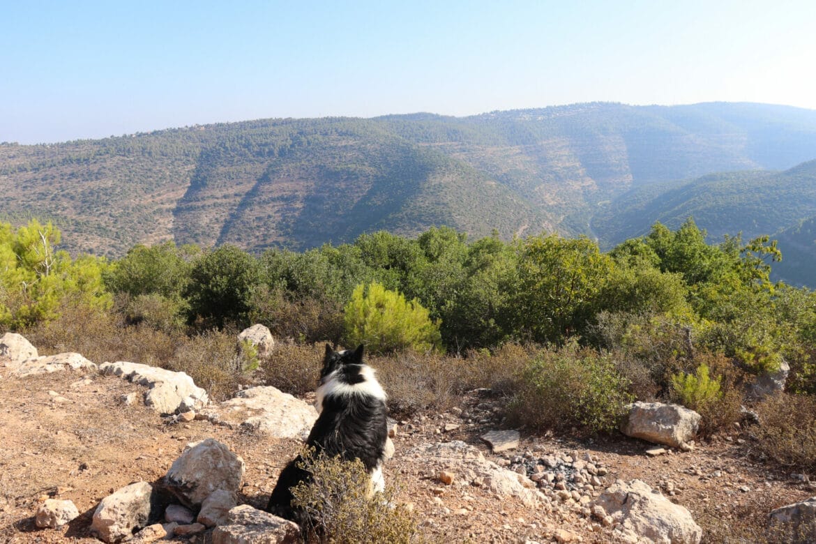
There was one loop that we actually hadn’t hiked before. We had touched on bits and pieces of the complete trail. And according to the map, there wasn’t anything particularly noteworthy on this piece of trail. But since the path was above the Sorek valley, we were guaranteed to have beautiful views.
And we just weren’t in the mood to go squill flower spotting.
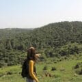
Moments later, we had our backpacks on and were setting off on a spontaneous and unplanned adventure in the hills above Nahal Sorek. It turned out to be a great day, full of all sorts of exciting and fascinating discoveries.
Here’s how we hiked this super fun and spontaneous 7.5 kilometer loop trail in the Nahal Sorek Reserve:
Climb Every Mountain
I felt such relief to be hiking instead of driving. The trail was green and forested, and the smell of sweet pine wafted through the air. We began by walking above a green valley, with Mount Ya’ale to our left. We’d hiked around Mount Ya’ale a few times, but we had never been to the summit. And according to the map, there was an extremely hard to reach summit that was quite beautiful waiting for us a few hundred meters away.
That day seemed like the day to go for it. So we took off through the thorns and trees, following animals paths as we climbed the mountain. After a while of fighting with thorns, we began to notice little red ribbons tied to tree branches. We started following them. And soon, we reached the quietest, prettiest mountain top anywhere in the vicinity.

It felt like we were truly all alone, in the middle of nowhere. We sat down on some rocks and just took in the silence amongst the trees and shrubbery.
After some quiet moments, we vowed to come back to this quiet mountaintop close to home some time soon, and set off to return to the main trail. This time, we followed the red ribbons all the way back along a much clearer pathway.
Familiar Terrain
Next, we were following the black trail down into the valley. This part of the hike seemed quite familiar to me. And we soon established that we had been there before as part of a journey to the nearby Stalactite Caves.

This time, we continued along the black trail rather than turning right onto the red trail to reach the caves. We passed by tall squill flowers (see, we didn’t need to go squill flower spotting after all!) and gnarly oak trees. And soon, we had reached the next off the beaten track adventure: a path to some ancient ruins on a peak above the valley.
Hirbet A Ras
We followed the unmarked path up and over rocks, downhill and uphill, towards an impressive structure protruding above the valley. It wasn’t easy walking. There were overgrown thorns, pokey dried grasses, and lots of boulders to climb over.
We crossed a patch of savannah like scenery, and then we were there, climbing up to the very top of Hirbet A-Ras.

There were all sorts of stories we could have made up about the pile of ruins. Judging from the water cistern, ancient pottery, and stone walls, it wasn’t a modern structure. We guessed that perhaps it was somehow connected to the Hasmonean fortress at Hurvat Toura. Or maybe it was left over from a more recent period in history. As hard as we tried, we couldn’t find anything that placed this hurva at any point in the past.
Rather than think about it too hard, we enjoyed the beautiful breeze and captivating views. Hirbet A Ras was deemed the perfect spot for an iced coffee break. We poured ourselves each a cupful, and took in the wild, silent beauty that was all around. From our perch on top of the hill, we could see Shimshon’s Cave, Nahal Sorek, and even Beit Shemesh in the distance.

After breakfast, we packed up and headed back along the very unbeaten path towards the black trail. It was time to get moving.
The Long Journey Home
Once we were finished with our off the beaten track explorations, we walked along the black trail at length, through rocky, shady terrain. It wasn’t a trail for fast-moving– there were rocks to climb up and down on, and the occasional overgrown branches to avoid. But it was beautiful. And it was nice to be out of the sun.

As we walked above the valley, we soon passed Hurvat Toura on our left, an ancient Hasmonean fortress sitting on a peak in the valley. Eventually, we reached a dried-up spring and the turnoff to the blue trail.
We climbed up the blue trail, working for every step of ascent, through the trees and over rocks and boulders. Soon, we reached the flat black trail above Nahal Sorek. We would follow this path all the way back to the trailhead.
Easy Walking
From here on in, it was easy walking, along a flat path that is also used by bicycles and 4×4’s (although we saw none that day). Looking down at my legs as I walked, I felt like I had accomplished something that morning. I had started the morning feeling kind of lost. But many scratches, scrapes, and bumps later, I had taken the kind of adventure that I had really been longing for. We had explored new and uncharted places, using a map and our own physical strength.
This part of the mountain range above Nahal Sorek may not be particularly user friendly or easy to get to. But our spontaneous 7.5K loop hike that day had allowed us to explore a beautiful part of Israel that we had never encountered before.


Hikers’ Notes:
Here’s what you need to know to hike this trail above Nahal Sorek:
- This is an all season trail. The path leads through a mixture of sun and shade.
- You can hike this trail without heading off the beaten track at all. If you skip the detours to the top of Mount Ya'ale and to the hurva, you will be following marked trails the entire time.
- Make sure to wear a hat, good hiking shoes, and long pants to protect yourself from thorns on the trail. Bring plenty of water.
- The terrain on this trail is challenging, with plenty of ascending and descending over steep rocks. Good hiking shoes are a must.
- To follow the trail without detours: From the trailhead, make a left and follow the black trail. When you reach the blue trail, follow it to the right until you reach the next black trail after a couple of minutes. Then follow the black trail until you reach the blue trail. Turn right on the blue trail and then turn right on the black trail. The black trail will take you back to the trailhead.
- Use the trail map in the table at the top of the page to help you locate the detours. The first detour is to the top of Mount Ya'ale. The easiest way to get there is to follow the black trail to the blue trail, then search for an obvious path up the mountain. After a couple of meters, red ribbons will lead you to the top of the mountain (if they are still there - otherwise, you're on your own!) Return the way you came.
- The detour to the hurva is fairly obvious and easy to follow. Use the trailmap to find its general location. Then follow an obvious unmarked path towards the ruins. You will see them in the distance. The path will lead you almost all the way there. The last meter or so involves climbing over rocks to get to the top. Return the way you came.
- Use the trail marker gallery, trail map, and Google Earth file in the table at the top of this page to find your way.
Don’t forget to read my guide to the navigational features in this post before you hit the trail!
Trail map from Amud Anan.
Questions? Have you hiked this trail? Let’s hear about it in the comments!


We love your site! What map are you using to check off the hikes? I’m sure you’ve mentioned it before, but I don’t see it.
Hi there! Do you mean which map app we use out on the trail? If so, it’s Amud Anan, which I highly recommend.