| Trail Map | Terrain View | |
| Distance: 8.5km | Time: 3-4 hours | Difficulty: Moderate |
| Ascent: 225m |
Click here to go straight to hike notes.
I’ve been hiking in Israel for years. And in my time exploring the country, I’ve seen most of its terrain.
In the south, there’s desert land. Near Jerusalem, there are mountains, which turn into foothills further west and then to flat plains near the coast. In Northern Israel, there are rolling hills, streams, and waterfalls. The area in the southern Galilee is home to the mountains and springs. South of that lies the Jordan valley, and so on and so forth.
So, it came as a surprise to me last Friday when I encountered a different type of terrain in a part of the country which I had never been to before, at Karmei Shomron near Kfar Saba.
Karnei Shomron is a large town surrounded by smaller towns. Those who live in the town love the location – remote, but still close to Central Israel. Beneath the mountaintop community, hidden in the valley, lies a beautiful seasonal stream called Nahal Kana.
There are dozens of different ways to hike at Nahal Kana. You can hike in a large loop, covering most of the stream and the surrounding area. Or you can access the stream from various points in the middle, going on an easy out and back hike to one of several springs. We chose to hike a mid-length, circular trail at the Nahal, beginning in Karnei Shomron and heading out to a large spring before turning around to make the return trip above the valley.
It was a great choice. Our hike at Nahal Kana was lovely, and included a mixture of farmland, a shady valley, freshwater springs, and beautiful views. In some ways, the terrain at Nahal Kana was different than anything else I had ever seen around Israel.
Here’s how we hiked this 9 kilometer loop trail at Nahal Kana in the Shomron.
Pretty from the Get Go
We pulled up on the side of the road near the black trail and began our journey. Right away, I was impressed with the beauty of the place. Tall flowers popped up from the sides of the trail as we followed it down into the valley.
After a little bit of walking, we encountered some donkeys tied up near the pathway. We seemed to be approaching a farm of sorts. Soon, after passing rows of olive trees, we heard the bleating of baby goats.

There were dozens of them, big and small. The larger goats hurried off into the corner, and speckled baby goats pranced after them, squealing and bleating as they chased after their mothers.
This area was very picturesque. It felt like we were in a foreign country, far away from the urban sights and sounds of Centra Israel.
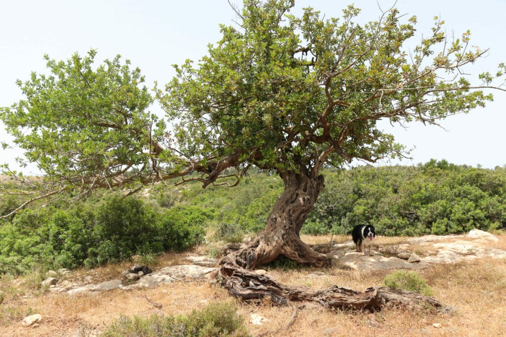
Tree Magic
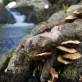
We passed by the farmland and progressed into a quieter part of Nahal Kana. Looking up at the sides of the valley, we could see that the slopes were covered in beautiful, bushy trees. As we walked, we passed one great picnic spot after another. Carob trees and oak trees had grown gnarly and wide, offering plentiful shade under their sprawling canopies.

Along the way, there were flowers and butterflies. Lots of butterflies. They flitted along in a flurry of black and white, dancing between the bobbing white and purple flowers on the sides of the path.
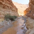
We had come hoping for water in the stream, but there wasn’t much of it here. Whatever had once flowed through Nahal Kana had dried up by mid-May, leaving behind thick green growth.
Can’t Pass this Place Up!
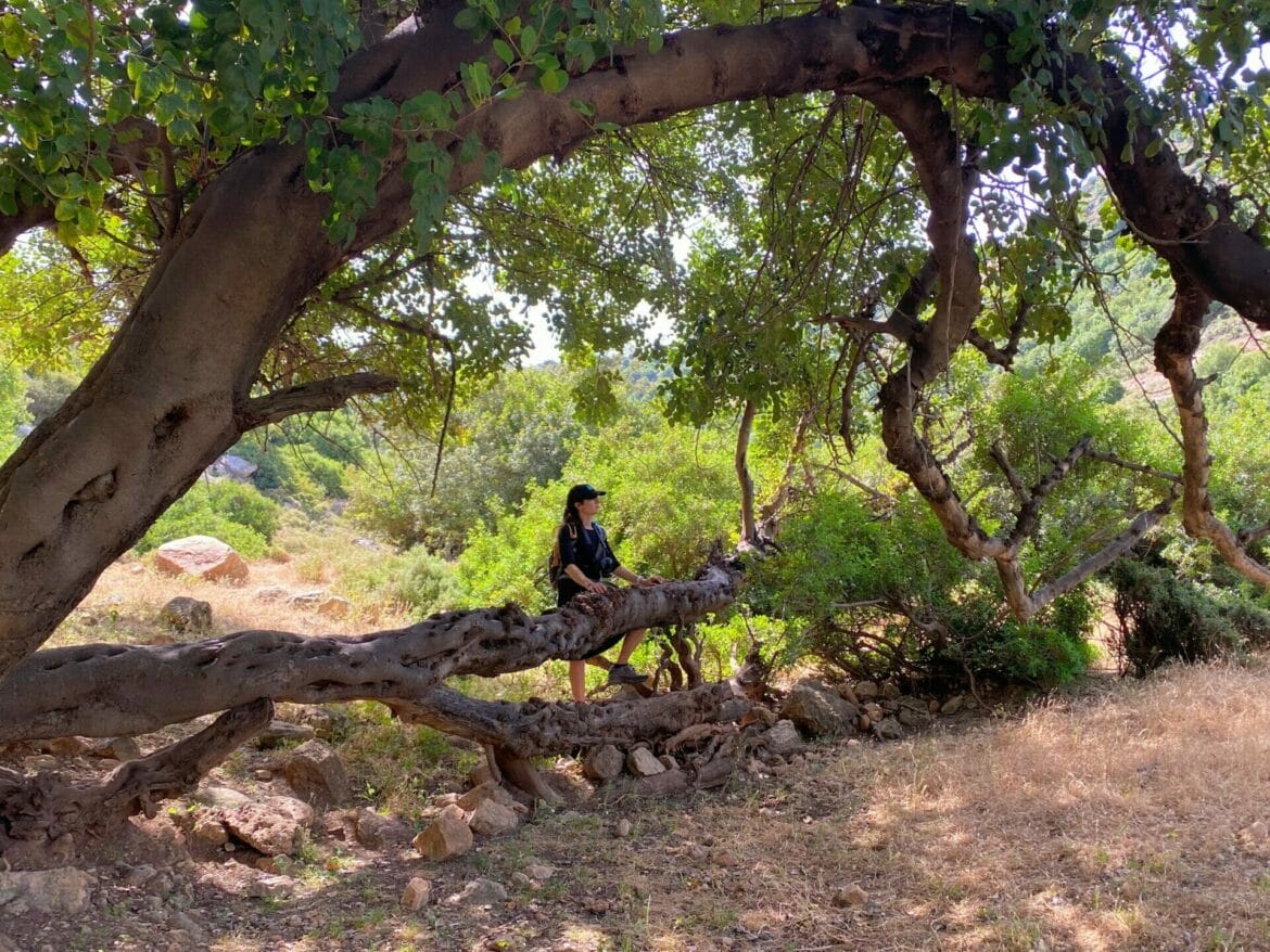
Along the path, one large tree captivated our attention. Its trunk and branches seemed to twist and turn in every direction, providing ample seating under an enormous leaf canopy. Nearby, splotchy cows hid in the forest, revealing themselves through the gaps in the foliage every so often.
After hanging around this tree for an unusually long time, we decided that we may as well stop right there and have our morning coffee. There couldn’t have been a spot more perfect. We curled up on the rocks and roots and pulled out iced coffee and apple muffins.

There was something about that place. Maybe it was the silence, the feeling that we were really and truly all alone. Perhaps it was the gentle beauty of the branches and roots that twisted about. Or maybe it was the cows peeking through shadows. It felt like we had been placed within the pages of a storybook.
Toward the Water
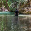
After breakfast, we packed up our things and moved along, hiking through Nahal Kana in search of spring pools. At this point, we knew that we weren’t going encounter a flowing river. But perhaps some of the many springs along the way would be full.
And they were. After a short walk through the valley, we reached a pretty pool of water. A family sat in the shade nearby, enjoying an elaborate picnic. We took off our shoes and waded into the cool water up to our knees (although word on the street said some parts of the pool were deep enough to jump into).
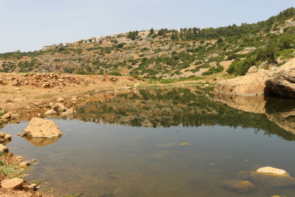
While we cooled down, a few young women from the picnicking family came over to chat: they were sisters, English teachers from the city of Shechem. We had a delightful conversation with them in English and taught each other new words in Arabic and Hebrew. They graciously invited us over to share their lunch: potatoes cooked on the fire and grape leaves stuffed with meat, peppers, onions, and mint.
But it was time for us to get going. So we thanked them, said our goodbyes, and turned back towards Karnei Shomron.
Bird’s Eye View
Now, we were walking along the bike trail, which took us up through the trees to a path overlooking the valley. From here, we were able to get a real sense of the terrain of Nahal Kana. When water flows through the stream, it runs all the way from this part of the country out to the Mediterranean Sea. We could see the stream bed winding through the mountains, then disappearing in the distance.
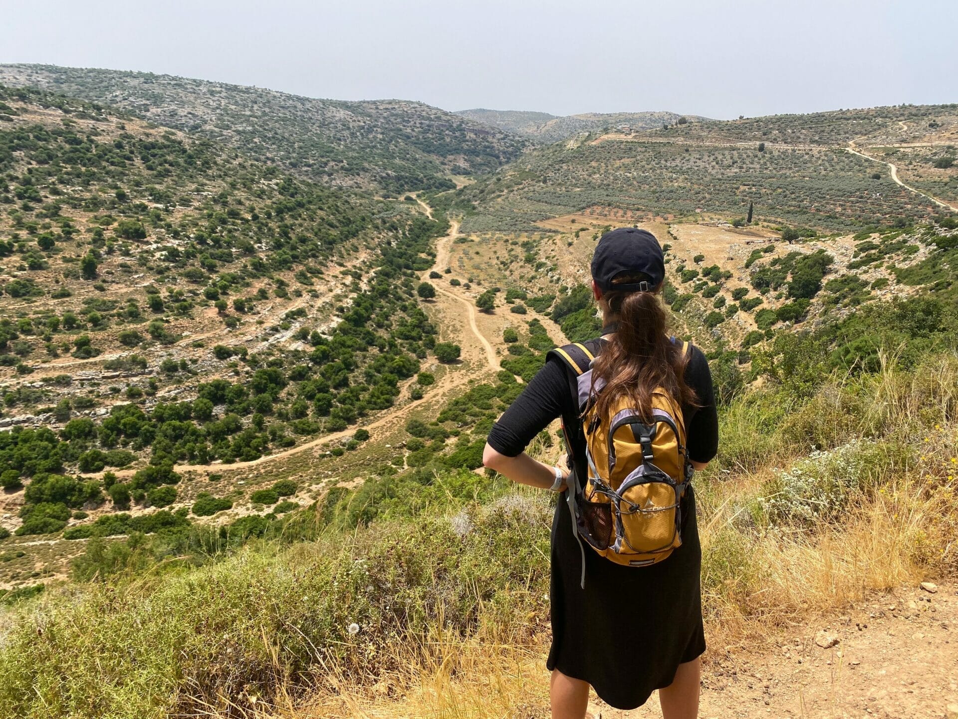
We soaked up the views as we hiked above the valley. Then, after following the path from shade tree to beautiful shade tree for quite some time, we emerged onto the road. A minute or so later, we were back at the trailhead.
Our hike through Nahal Kana that day had been surprising. We came expecting a flowing river and uninteresting terrain. Instead, we walked through a valley full of rich beauty, a place where picture perfect trees, springs, and farmland come together to create enchanting terrain. After so many years of hiking in Israel, Nahal Kana was a welcome change in scenery.


Hikers’ Notes:
Here’s what you need to know to hike this trail at Nahal Kana:
- This trail is best for cooler days in the fall, winter and spring. In the wintertime, see the stream flowing through the valley!
- This trail is in Judea and Samaria. Make sure you feel comfortable with your level of personal safety before hiking in these areas. Before you hike the trail, inform local security services by calling this number: 09-7929222
- Officially, dogs are not allowed on this trail.
- Wear good walking shoes and sun protection, and bring plenty of water to hike this trail.
- To follow the trail, use the trail marker gallery and the trail map in the table at the top of this page. Or, use the Google Earth file to stay on track while you are on the trail.
- Trail colors: Begin on black. Hike out to the spring on black. Then turn back until you reach the place where the bike trail and the black trail meet. Turn right onto the bike trail. The bike trail will take you all the way back to the beginning. Then turn left on the street to get back to your car.
- This trail is not always easy to follow, as the trail markers are hard to find. Use the Google Earth file for extra help.
Don’t forget to read my guide to the navigational features in this post before you hit the trail!
Trail map from Amud Anan.
Questions? Have you hiked this trail at Nahal Kana? Let’s hear about it in the comments!