

| Trail Map | Terrain View | |
| Distance: 13.7km | Time: 5.5 hours | Difficulty: Expert |
Ramon Crater is a force to be reckoned with. At 40 kilometers long and up to 10 kilometers wide, it’s no small feat to try to really see the crater to the fullest. Which is why we knew that for the second hike of last week’s trip to Makhtesh Ramon, we needed to pick an intense, all day trail and cover a lot of ground.
We thought about hiking to Shen Ramon (a peak of volcanic rock), but that trek is part of the Israel Trail. It’s a popular hike. We wanted to go somewhere that would be quiet, where we would have little chance of meeting big groups en route. So we chose to climb Ardon Mountain instead.
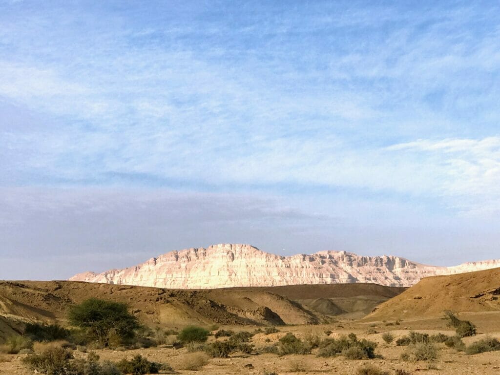
Ardon Mountain is a white and rugged flat topped mountain that looks like a picture on a postcard. It sits on the edge of the crater, jutting sharply into the emptiness, and its ascent and descent are part of a 13 1/2 kilometer loop trail.
The trailhead is at the end of a bumpy dirt road near the Beerot Campground. The whole thing took us about five and a half hours to complete – and we still had plenty of light left in the day to see some other sites around the crater when we were finished.
Here’s the lowdown on this climb, for experienced hikers only:

We started off walking on the black trail trail through the typically wild Ramon Crater scenery – flat desert with low hills of red and black in the distance. Then, we reached a large black hill, Givat Herut, with a picnic area nearby. We passed by this little peak and turned onto the blue trail towards Ardon Mountain.
From here, the ascent began. First we were gently climbing up red rocks as we approached the mountain. Then we were on a yellow sand path, which reminded me of walking down the Yellow Brick Road toward Emerald City. But before long, we were at the foot of a massive climb – pale rocks like uncut gemstones, glistening in the early morning sun.

It seemed almost too steep to go up. We didn’t have mountain climbing gear – just our usual sneakers, backpacks, and plenty of water. But sure enough, as we got closer, the hikers’ road revealed itself: a white smooth pathway that headed straight up the mountain.

So we began to climb. It was actually easier than we expected. The footing was sure most of the way through. We stopped every so often to take in the amazing moonscape view of the crater.

As we got close to the top, the uphill became even steeper. We were pushing ourselves to the max. But before we had a chance to tire out, the near vertical ascent stopped, and we reached the first plateau of the mountain.

From here we took it slower and easier, stopping to check out our surroundings and analyze the crazy rock formations at the top. Oddly enough, there were birds and black butterflies drifting around at the top of this rocky crag.
The views from here were spectacular – the scenery awe inspiring. There seemed to be no one for miles around. The wind blew in our faces as we surveyed the dry riverbeds, volcanic rock, and red hills that filled the crater.

We spent quite a while taking it all in at the top of Mount Ardon. Then, ready to see the rest of the scenery, we began our descent. We had only hiked a few kilometers of the 13 ½ kilometer trek, but we felt that the hardest part was over.

From the highest point of the mountain, the blue trail continued at a much less dramatic incline back down. Once we reached the bottom, we turned onto the green trail for the last several kilometers of the hike.
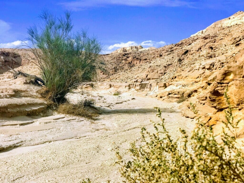
There were lots of things to see on the green trail. There were dry riverbeds, which fill up with gushing rain water during a storm. The flowering plants, smooth sand, and river rocks at the bottom of the beds were a testament to the water that flows through on a rainy day.
Along the way, we climbed down into a particularly pretty riverbed to sit and take a break for lunch. The colorful stones in this area were incredible. The red walls framed out a sea of bright yellow, purple, and grey river rocks at the bottom.

Rested and refreshed, we continued on the green trail through the desert. We passed a bright red cliff jutting out of the ground. The stone inside crumbled to the touch. We walked through fields of jet black stones, strewn around – a Martian landscape.

And before very long, we had completed the loop and ended up back at the blue trail, back onto black, and returned to the trailhead.
This incredible hike really gave us some quiet time in Ramon Crater. We didn’t meet another soul in all five and a half hours (not even an ibex!) And the scenery was otherworldly and super interesting the whole way through.

And Ardon Mountain? Climbing 430 meters to the top felt like a real accomplishment! Tackling a peak in this incredible land may not be as impressive as climbing Mount Kilamanjaro, but it’s our land. And it’s beautiful and breathtaking. And being able to reach another amazing view in quiet solitude is worth every step of the climb.
Note to Israel Explorers: I really really loved this hike. In fact, I loved it so much that I’m starting a Mountain of the Month section, where I’ll try to tackle a different peak in Israel every month. Let me know if you have any suggestions!
Remember, only attempt this hike if you are in good physical condition. This isn’t a hike for kids. And the best time to explore the Ramon Crater is in the rainy season, when the cool weather makes desert trekking feasible. (See why I love winter hiking here.) So put this one on your list of great winter hikes to try.
You can follow my maps above to get to the hike, and use the Google Earth file to walk your way through on the Google Earth app. It’s also a good idea to stop at the Ramon Crater Visitor’s Center for a map. And as always when hiking in the desert, make sure to keep the next trail marker in sight, and pay attention to the path.
New! Read this guide to how to use navigational features in this post.
Have you climbed Mount Ardon? Questions about this hike? Let me know in the comments below!


Hi – is there a way to cut down the length of this hike? Want to do it with kids (who are fit/tested hikers) but reduce the total length if possible. Thanks!