

| Trail Map | Terrain View | |
| Distance: 6.5-7.5km | Time: 2.5 hours | Difficulty: Moderate-Strenuous |
| Ascent: 173m |
If you live in Bet Shemesh, Beitar, or Gush Etzion, you’ve probably driven by this hike hundreds of times. I know I have!
Sometimes it seems like there are no real natural forests near where we live – no woodland paths or long and rambling trails. But I’ve got news – there are lots of them…really really close by.
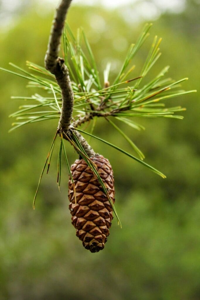
This hike up to the “summit” of Har Giora is a perfect example. Nestled in a forest off the highway between Beitar and Bet Shemesh, this excursion is a combo of almost everything you would want in a hike.
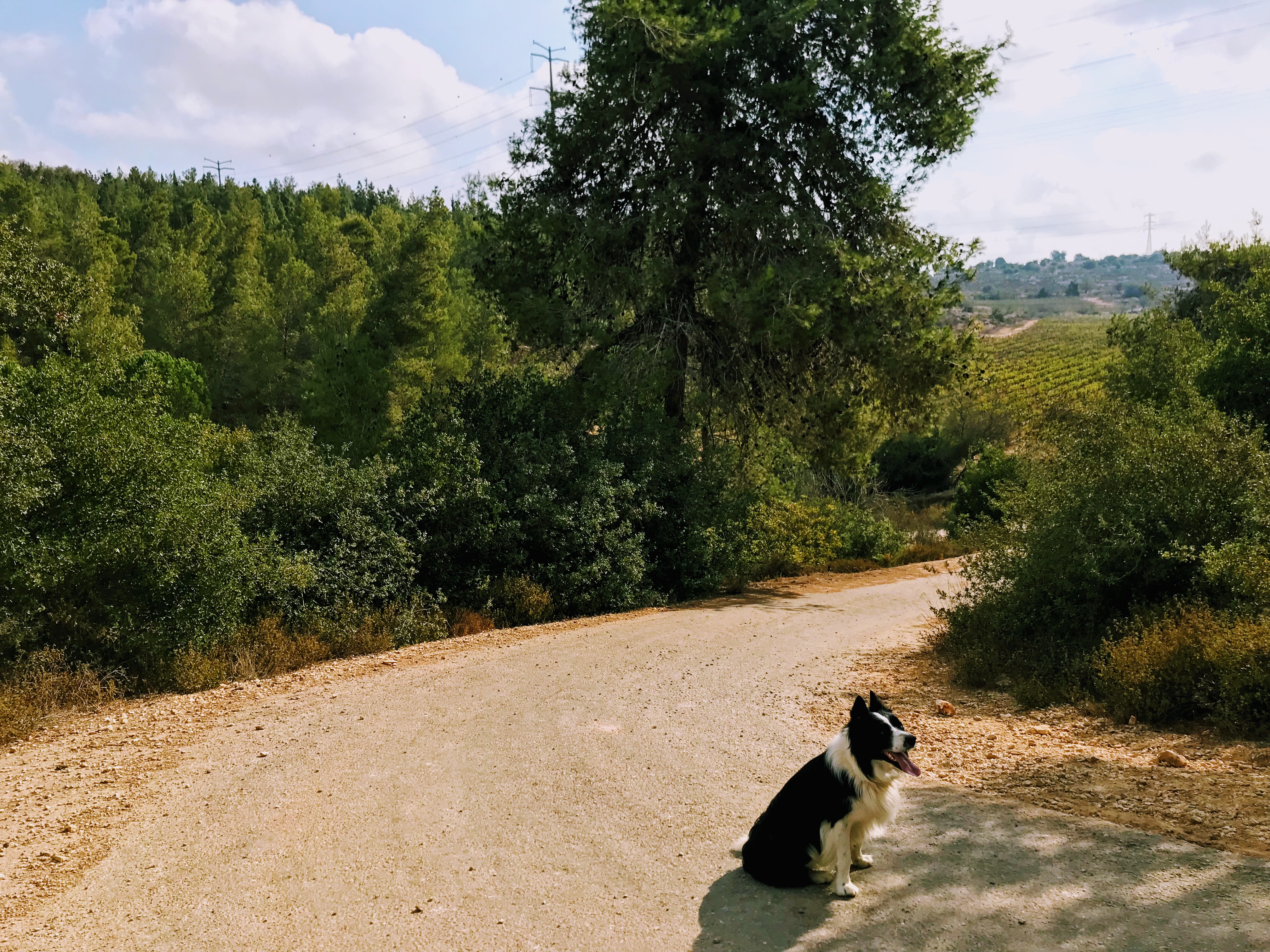
There is a long paved road for easy walking, vineyard views, and tall shade trees. There’s also a more rugged part of the path – a dirt road surrounded by lush greenery, a bit of rock climbing, and at the very top of the mountain: a sheik’s burial site.
I know, it’s funny to find a sheikh on a nature hike, but this is Israel, and antiquities are everywhere. For the most part though, this hike is more about natural beauty than history.
Here’s how we hiked this trail:
On the Trail
We start our 7.5 kilometer walk at a little “lot” right off the highway (in Park Begin). From here, we follow the blue and orange trail markers down a road until we reached the black trail.
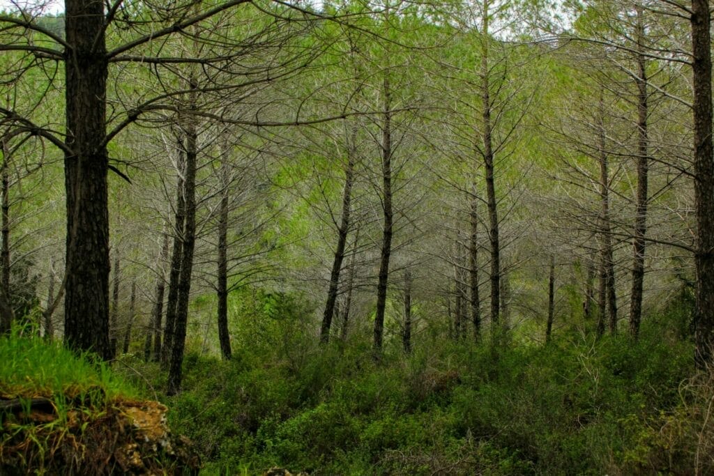
Here, we make a left turn. The trail turns from a paved road overlooking valleys of vineyards to a woodland path surrounded on both sides by tall trees.
Even here, we don’t have the path completely to ourselves– we see a few mountain bikers ride past. On a beautiful fall day the crisp air and puffy cloud filled sky makes it easy to continue along without breaking a sweat.
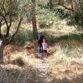
We follow the red trail for a while until we get to a fork in the road. Here you can call it a day and turn back or take the green trail to the left – it snakes up and around to the top of Har Giora and then back down the other side.
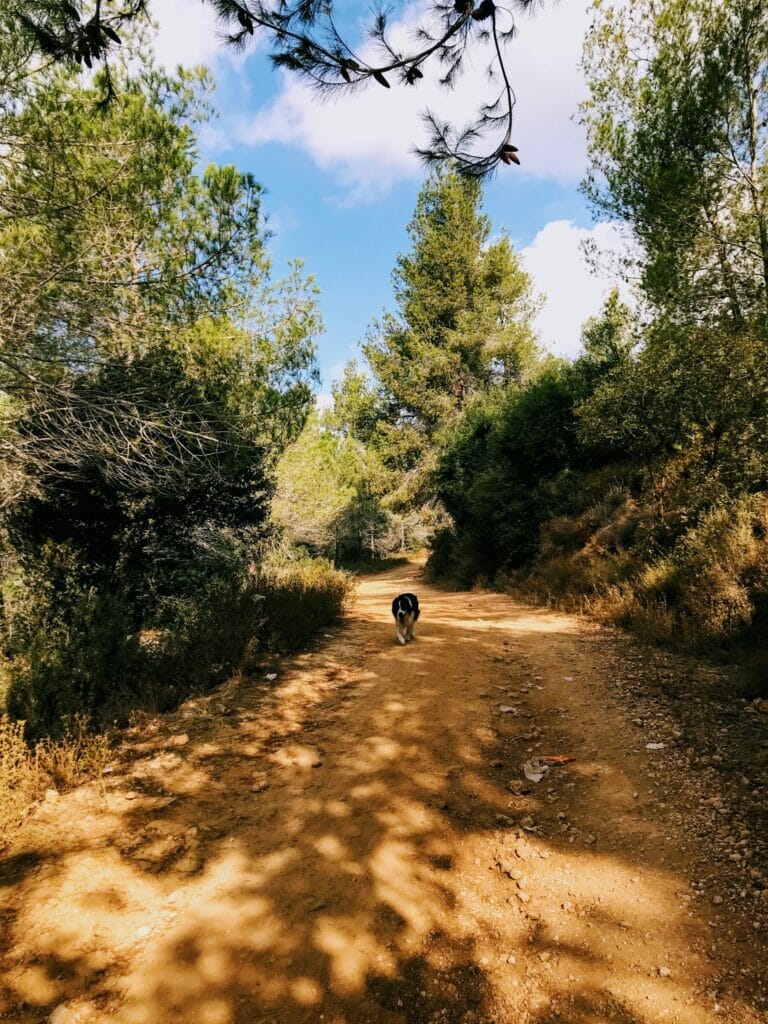
This trail is quieter and more secluded – no 4X4s or even mountain bikes can make their way through here. There’s a bit of light rock climbing and a gentle ascent which takes you past the valley views that surround the mountain.
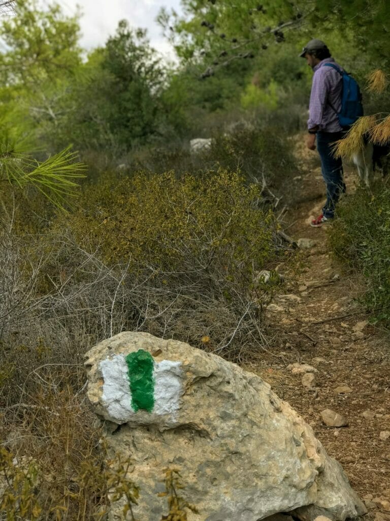
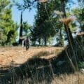
So up we go. Sometimes we have to push back the shrubbery to pass through– it is clearly the road less traveled so it’s kind of overgrown in a wildly beautiful sort of way. But there are green trail markers at regular intervals to help us follow the path.

After we walk for a while we stop – to take in the incredible views. When you’re here climbing up Har Giora, it’s hard to believe that you’re only fifteen minutes from the big city of Jerusalem. There are valleys filled with trees on all sides, and the only sounds around are birds chirping and the wind blowing through the trees.
We have to smile when we finally reach the top – here it is, the sheikhs burial chamber.

According to the legends, Sheikh Marzuk was a holy man who helped the Sultan with his army, thereby earning the privilege of being buried atop a mountain. So on this mountain he remains.
We climb up to the top of the tomb for an awe inspiring view. Looking around, we can see lush, tree covered valleys and mountains on all sides. And in the distance, the city of Jerusalem glows brightly, a circle of white stone buildings in the skyline.

After a coffee break, we continue along the green trail back down the mountain. We’ve got another several kilometers of trekking back in the other direction to where we began, but since the paths are circular, there’s different scenery for most of the way.
The green trail joins the red trail. And then back to black.
After all is said and done, we’ve spent about two and a half hours walking through this stunning scenery. We’ve gone up and down, and yes, we’ve broken a sweat. Our legs are tired but our spirits are uplifted.
Exploring the wilder side of Israel is easy with beautiful hikes like this so close to home.


Hikers’ Notes
This hike requires a good pair of sneakers or hiking boots and about three hours. There is some exertion involved – so fill up a few bottles with water and be prepared!
My goal for this site is to provide images, descriptions, and clear maps (accessible from your phone) which will bring you straight to and safely through each hike that I write about. I haven’t perfected my system yet, but stay tuned for updates to this post with maps and more. Until then, feel free to leave any questions or comments in the box down below!
Update: I’ve finally managed to update this gorgeous hike with maps, GPS data, and new pictures. Now you can find your way on the trail by using Google Earth or following the trail map attached up above.
The directions are really simple. Follow the Israel trail until you reach the first crossroads. Turn left onto black. Black runs straight into red. Red eventually hits green (slight left). Green goes back to red. (Make a left onto red.) . Then when you hit the black trail again, you can continue straight onto black for a slightly longer loop or turn right to go straight back to your car. We took a longer loop to the left .
From here, we followed the Israel trail (going right at every fork in the path), until we reached the first crossroads we hit at the beginning of the hike, where we took the black trail. Here, we take the path on the left back to the car.
Just keep an eye out for trail markers!
And now that I’ve hiked this trail in the winter time, I have to say that the scenery is even more beautiful than before. So go any time – but make sure to go back in the winter or spring.
Don’t forget to read my guide to the navigational features in this post.
Trail map from Amud Anan.


")

.")
 back to your car.")


Hi Susannah, my parents are here. I’d like to walk part of the Har Giora hike with them. Major uphills and uneven paths are out of the question. Is there a kilometer or so that we can walk on a flat open road?
Thanks
Tracy
Hi Tracy. I am not sure Har Giora would be the right choice for them. There is a major downhill fairly early on (right after you hit the black trail), which they would have to climb back up to return. The Ein Kobi walk is probably a better hike option for your parents.
Chag Sameach!
First of all, your site is really great!
What site do you use to create the trail maps? It looks like it has all of the different trails with colors marked, but I’ve visited a lot of sites in Hebrew and English and can’t seem to find a map with the trails. Thanks!
Thanks Daniel!
I use Amud Anan to create the trail maps. If you love hiking in Israel, it’s worth checking out their site/app. They have almost every trail in the country on their maps. The site is a little technical and takes patience to learn how to use, but we’d be lost without them 🙂
Fantastic, thank you!
Thanks so much. Did this hike today. Perfecrt weather and level of difficulty for us. Thanks so much for this fabulous idea. Just one thing – the waze link took us to the wrong place and it took us a while to find where we were supposed to be. https://waze.com/ul/hsv8uqrfys I think this one should work
Thanks for your comment and tip!
I did this trail today and it was amazing! It was a hot day and the trail was shady nearly the whole time, so it’s a great option for summer months. The length was perfect for me- it was a nice workout but not too hard.
I had a hard time finding the beginning of the trail. I parked at the Bar Giora camp site and then walked on the highway until the beginning of the trail. However, on the way back, I followed the black trail all the way back to my car, so I was able to avoid the highway. Once I got situated and figured out the starting point, it was perfect!
I’ve been doing a lot of hiking and camping around this area recently (Kobi, Se’adim etc.). I like to hammock camp which requires two relatively big trees with mostly clear ground in between. The pines that were planted in these forests is usually great, but I was wondering, do you remember if there are large trees near the top of the mountain where there might be a good view? Thanks!