| Trail Map | Terrain View | |
| Distance: 7.8km | Time: 2-3 hours | Difficulty: Moderate |
| Ascent: 268m |
It’s that time of year again: the warm and dry season has settled in here in Israel. Gone are the breezy, flower filled hikes of springtime, and the perfect-for-the-season desert hikes of winter. At this time of year, we must carefully consider which trails will be pleasant despite the heat and the change in nature’s color palette.
During late spring, summer, and early fall, we invariably favor Jerusalem Mountains hiking paths. In this part of the country, there are plenty of trees to keep things green and shady, and the mountainous terrain translates into cooler temperatures. It also helps that the Jerusalem Hills are close to my hometown in Gush Etzion.
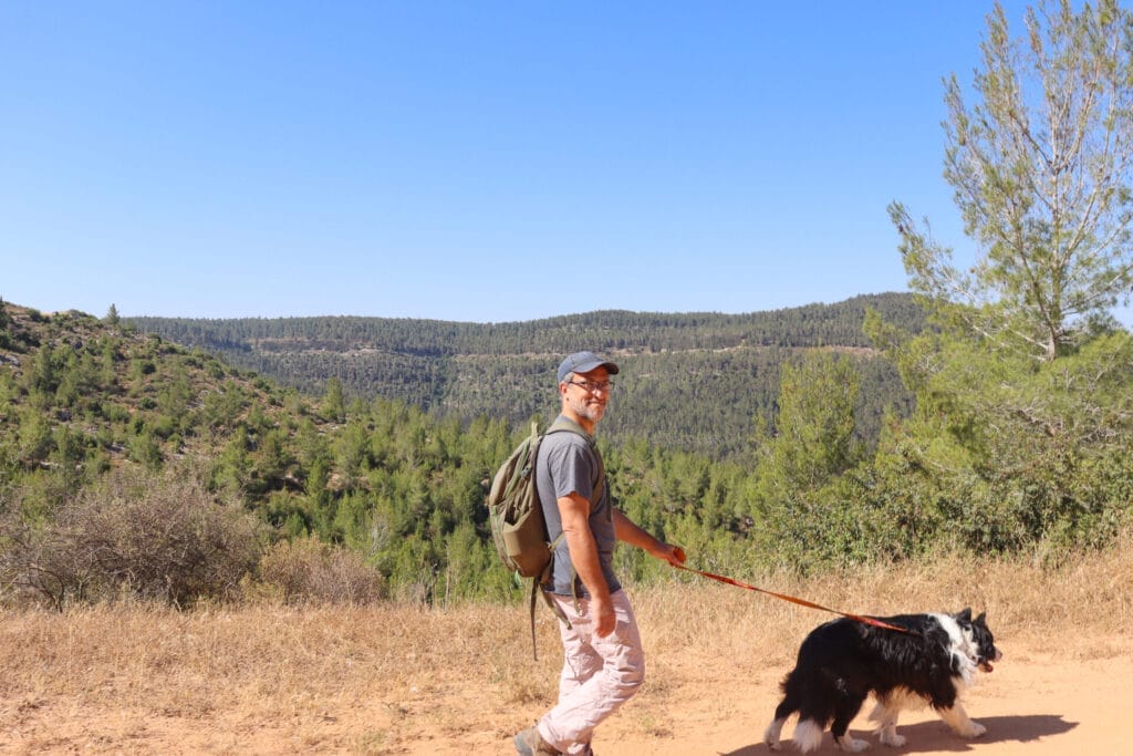
This past Friday, we were on the search for a new local trail. I had recollections of a spot near Hurvat Seadim (the beginning of the Jerusalem Springs hike), where I had seen several different trails snaking together. I consulted the map and discovered a lovely loop trail that would hit some of my favorite spots: Hurvat Seadim, green and glorious Mount Shalmon, and quiet, beautiful Havat HaGitot, all on one 8 kilometer adventure.

My husband was only too happy for another opportunity to hike to Havat HaGitot. We never fail to have an awesome experience on that ancient mountaintop. So, bright and early last Friday morning, we set out for the trailhead.
We had a wonderful hike that day. The scenery was spectacular, with green mountain views, and the weather was gorgeous. It was even a little breezy. We had a great time picnicking in the shade at Havat HaGitot midway through our journey.
Here’s how we hiked this 8 kilometer loop trail through the Jerusalem Mountains:
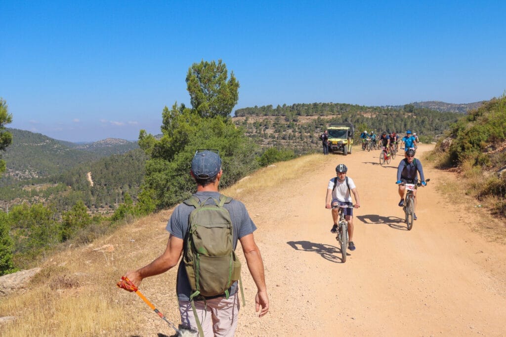
Bicycle Race
As I mentioned, we left early in the morning. That was because the road up to our town was scheduled to be closed between 7:45 and 9:00 AM, so heading out at our usual time wasn’t possible.
It’s always better to get out early anyway. We were looking forward to an early morning adventure, before the midday heat set in.

But guess what we discovered as we appraoched the trailhead? The road to Hurvat Seadim was also closed because of the bicycle race. This came as a quite a surprise – we were a half an hour’s drive from the closed road to our hometown. But we were determined to hike our trail. So we consulted the trail map and came up with an alternate approach to the trailhead.
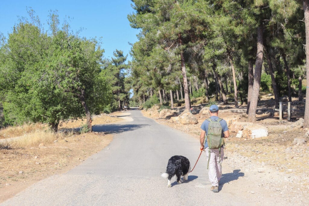
When we got there, we found the area sectioned off with plastic ribbons – no cars allowed. Luckily for us, we were ready to start hiking – no car needed! We crossed through the plastic ribbon away from the crowds of cyclists and onto a quiet, forest trail.
Quiet Forest Walking
The weather was still cool and breezy, and the air smelled of rich pine. Although there wasn’t anything particularly interesting about this trail, it was lovely to be hiking on a flat path through a quiet area, above gaping valleys, looking out at tree covered mountaintops. The sights and smells in the forest that morning were simply delightful. We needed nothing more than that quiet mountain path.
Rather than stop in one of the many beautiful picnic spots along the way, we decided to get our blood flowing by walking for a while. We passed right by thick forests, pretty lookouts, and other delightful looking stopping places.
Eventually, we came across an RV camper, and two camping chairs set up under a canopy of trees. It looked like a wonderful place to spend some time disconnecting from the modern world.
More Bicycles
Just as we were getting ready to stop for coffee, we crossed paths with the bicycle race once again. So, on we hiked. We walked downhill, watching packs of cyclists exerting themselves as they ascended the rocky mountain. Our path was no longer a quiet hiking trail, but on the positive side, it was quite absorbing to watch the variety of cyclists chugging along.

Finally, after a long while, we reached the turnoff, back onto a quiet trail towards Havat HaGitot.
At this point, we were more than ready to stop for coffee. But the top of Havat HaGitot was just a ten to fifteen minute climb away. And we remembered the gorgeous views and complete peace awaiting us at the top of the hill. So we climbed through the forest, one step at a time, until we reached the very top.
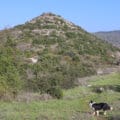
Then, we crossed through olive orchards and found the little circular path that toured the top of Havat HaGitot. We followed it, past ancient olive presses and late spring wildflowers towards a beautiful lookout under a canopy of pine trees.

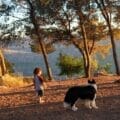
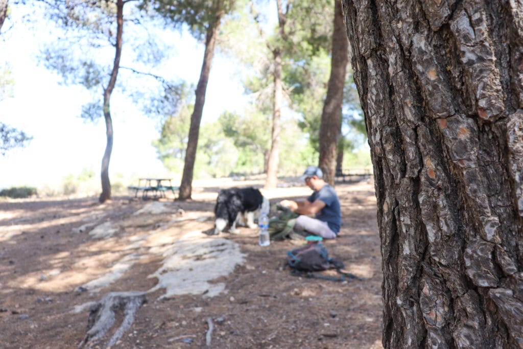
Complete Peace at Havat HaGitot
Havat HaGitot is one of those amazing places. We first stumbled upon it while we were hiking years ago. Since that day, we’ve been back a few times with our family, off-roading it in our family van to escape the hustle and bustle of life and enjoy a barbecue picnic and some time in nature.

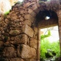
Aside from the fact that there are fascinating ruins at the site (from the time of the Second Temple Period) it is also beautiful up there…and quiet. We’ve gone there on Israel’s Independence Day, when every other barbecue pit in nature is occupied with crowds of merrymakers. Up at Havat HaGitot, it’s rare to see anyone at all.
So, we were very happy with our breakfast picnic at the top of that hill. Up there, under the cool canopy of trees, we had only the birds for company.
Finding a New Path
After breakfast, we followed the trail back around Havat HaGitot and made our way down to the marked path. Our plan was to follow a blue marked trail back in the direction of Hurvat Seadim. We found it (with a little bit of searching) and followed the narrow pathway over hills, past greenery and short shrubbery. It was beautiful, and wilder than the first trial we followed.

Soon, we reached the forested area of Mount Shalmon, which we had crossed through that morning. We enjoyed the cool respite of the shade as we hiked along in a peaceful place.
All Good Things Must Come to an End
Our day’s adventure had been perfectly peaceful (except for the bicycles). We were so thrilled to discover a new, moderate hike close to home. The woodland, the fabulous views, and the midway stop at one of our favorite places turned an ordinary hike into something spectacular.
After eight kilometers of woodland wandering, we finished up our hike. There were no more bicycles left at the trailhead. All was quiet again at Hurvat Seadim.
This lovely hike through the Jerusalem Mountains towards Havat HaGitot is a delightful choice for nature lovers looking for peace and quiet close to the Holy City.
Hikers’ Notes:
Here’s what you need to know to hike this trail from Hurvat Seadim to Havat HaGitot:
- This is an all season trail.
- This is a circular trail
- Suitable for dogs.
- There is a water point near the trailhead, but aside from that, there are no facilities on this trail. Wear good hiking shoes, sun protection, and bring plenty of water to hike this trail.
- Use the trail marker gallery, trail map, and Google Earth file at the top of this page to follow the trai
- The trail is well marked until Havat HaGitot. Once you're there, feel free to wander and explore! There is a very short blue marked trail that encircles the peak.
Don’t forget to read my guide to the navigational features in this post before you hit the trail!
Trail map from Amud Anan.
Questions? Have you hiked this trail? Let’s hear about it in the comments!