| Trail Map | Terrain View | |
| Distance: 6km | Time: 2-3 hours | Difficulty: Moderate |
| Ascent: 140m |
Last Tuesday was election day. And we all know what that means – vacation day in Israel! With the heaviness of war still thick in the air, we could all use some time to enjoy the beauty of Israel’s outdoors.
Luckily, this year’s municipal election day in Israel was also a perfect day for an excursion to see the winter wildflower explosion. The weather forecast for the day predicted beautiful weather in the morning, mild temperatures with clouds and just a few drizzles. And we had our sights set on an area of natural beauty called Shaharia Forest, near Kiryat Gat – we figured that the weather would be even more pleasant in that part of the country.
With the kids at home, we knew we needed to plan a hike that wasn’t too challenging. And since it was election day, we figured that everyone and their sister would be out enjoying Israel’s parks and natural spaces. Whichever trail we chose, it would have to be slightly off the beaten track if we didn’t want to fight car and foot traffic.

So, with these constraints in mind, we scoped out a mid-length out and back trail on the way quieter side of Shaharia Forest. Not only would we get to see beautiful flower fields on this trail, we would also get to visit a really cool historical site that we’d been interested in for a while: ancient Ziklag. Many scholars identify this town of biblical importance with Khirbet al-Ra’I, in Shaharia Forest.
Our election day hike to ancient Ziklag turned out to be truly spectacular. It couldn’t have been more perfectly suited to our needs that morning. We got to enjoy abundant wildflowers of every type, along with a cool historical site that was relevant to our own times. We all had a blast – and we returned to the trailhead just as the heavens opened and rains started to fall. It was a great day.
Here’s how we hiked this beautiful out and back trail to ancient Ziklag in Shaharia Forest:
Who Doesn’t Love this Place?
We began our journey with a brief stop in the main part of Shaharia Forest just across the road. It was early in the morning (about 9 AM), and already, the crowds were out, setting up tables and firing up grills. We had wanted to visit some of the more well known flower fields in Shaharia before beginning our hike. But an encounter with full parking lots and traffic on the trails made us change our mind. So, we drove back out of the park across the highway and set out to begin our quieter hike instead.

Stepping out of the car, we were greeted by perfect weather and beautiful mustard blossoms. I already had the feeling that it was going to be a great day.
We strapped on our backpacks and followed the (poorly marked) red trail up the hill next to the forest.
Surprise Photo-Op
After a bit of a walk through more forested area, we reached a large orchard full of almond trees, replete with white and pink blossoms that looked like puffy little clouds. In between the rows of almond trees, thick grass grew. I knew a photo op when I saw one.

My daughter and niece dutifully posed for the camera, while I snapped away. This spot was oh-so-beautiful. And we hadn’t expected to encounter a gorgeous forest of blossoming almond trees right in the middle of this trail.
Green Fields
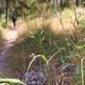
The nice thing about this hike was that the scenery was ever changing. After we made our way through the blossoming almond trees, we reached vibrant green fields, full of healthy looking crops. We took some guesses as to what was growing in these fields (the adults said wheat, and the kids thought corn), and before we knew it, a flock of sheep came into view. Then, beautiful red wildflower covered hills appeared.

Every step of the way, it felt like we had something beautiful to look forward to. We took in the site of blossoming anemone flowers, so picture perfect at this season. Although this was the “quiet side” of Shaharia, there were quite a few families and couples wandering through the abundant anemone blossoms and stopping to take pictures.
Our goal: to find the perfect quiet picnic spot in this incredibly beautiful place.
Mission Accomplished
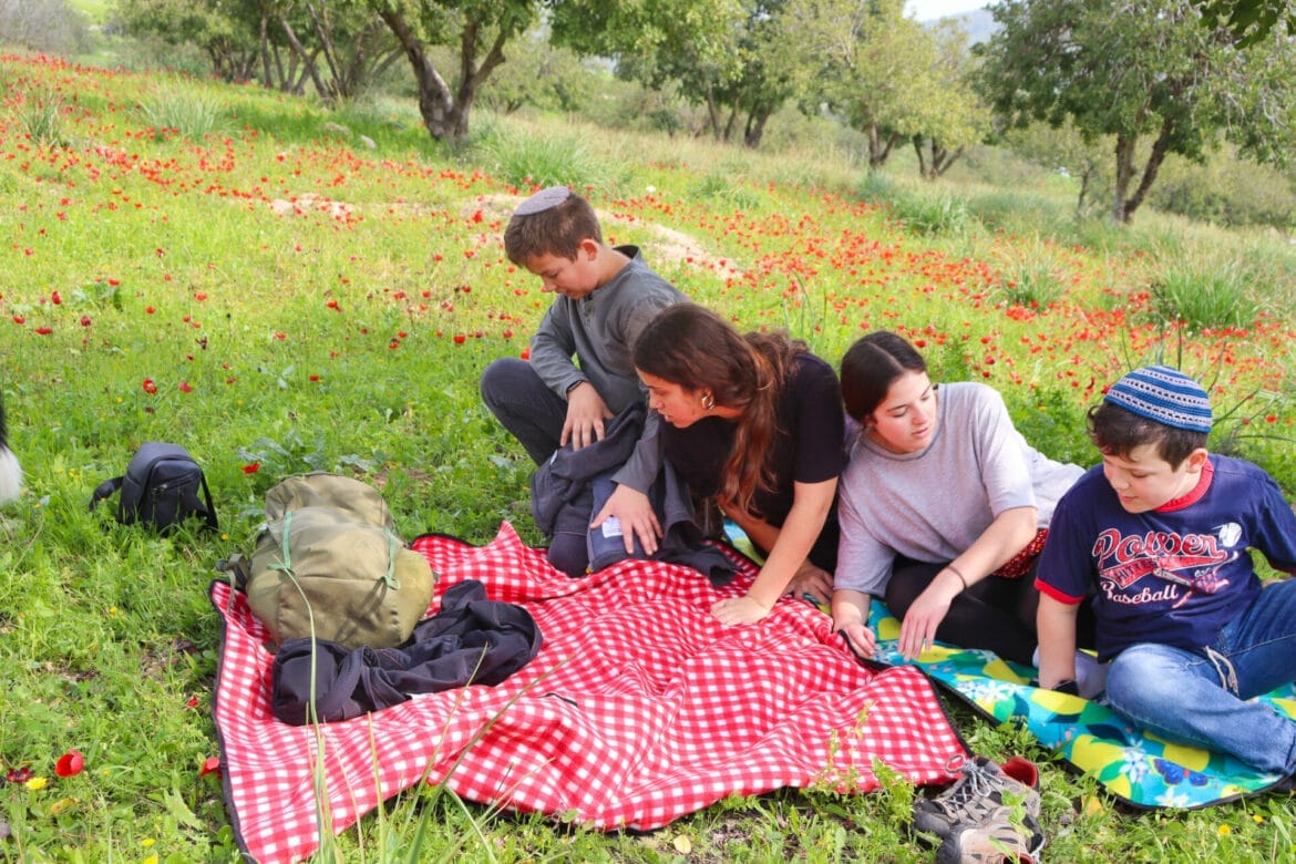
This wasn’t a very difficult goal to achieve. Just a bit away from the main path, we happened upon a shady carob tree surrounded by an absolute carpet of crimson anemone. We laid out our picnic blankets and settled in.

Usually, our picnics with kids don’t last too long. With their boundless energy, they don’t have patience to sit around. But that morning, we all wanted to stay in that spot for as long as possible. First, we ate breakfast, finishing every last bit of food in our backpack.
Then, we flew the drone for a while.
And finally, we took a nap in the sunshine. The scenery there was so spectacular, the spot so relaxing. Nobody wanted to leave.

Of course, we knew that soon enough, the weather would change. And we wanted to get to ancient Ziklag before that happened. Eventually, we picked ourselves up, put away our picnic blankets, and set out back on the trail.
Ancient Ziklag
It wasn’t long before we reached the ruins of Khirbet al R’aI, which some scholars identify as the site of ancient Ziklag. We had recently become familiar with the story of Ziklag after October 7th, when hundreds of Jews were kidnapped and brought into Gaza. During that time, many heard echoes of a previous tragedy endured by our nation, one that happened long, long ago. During the reign of King David, the Amalekites descended upon the town of Ziklag and kidnapped hundreds of Jews, including two of King David’s wives.

The people cried and mourned – many blamed the king. After a consultation with the high priest and the Urim veTumim, King David led his army south towards Nahal Besor on a rescue mission. They found the Amalekites making merry, drunk on their own success. The Israelite army recaptured every single hostage and killed the Amaleki men who had perpetrated this crime against the Jews.
May the remaining hostages in Gaza be returned safely and speedily.
All in a Day’s Adventure
After visiting the archeological sites, it was time to head back to the trailhead. On the way, we passed a mother sheep with her baby lamb. We picked wild irit blossoms and munched on them, along with sharp mustard flowers. And back we wandered through the blossoming almond trees and towards the forest. That was when it started to rain.

For the last few moments of our hike, we enjoyed a gentle drizzle and a darkening sky. We made it back to the car just as it started to pour.
Back in the car, we all agreed that it had been a fabulous morning: beautiful, fascinating, relaxing, and fun. Our short hike at Shaharia forest to ancient Ziklag was the perfect way to spend a beautiful February morning.


Hikers’ Notes:
Here’s what you need to know to hike this trail at Shaharia to ancient Ziklag:
- This trail is best in the winter and spring.
- Great for kids.
- Suitable for dogs.
- The trail is not shaded. On sunny days, make sure to wear a hat and sun protection.
- Bring plenty of water and wear good walking shoes to hike this trail.
- To follow the trail, walk out along the red trail. Check the trail map to find the turnoff along an unmarked dirt path to ancient Ziklag. When you finish exploring, find your way back to the red trail and go back the way you came.
- Use the Google Earth file to help you find your way along the trail as we hiked it.
Don’t forget to read my guide to the navigational features in this post before you hit the trail!
Trail map from Amud Anan.
Questions? Have you hiked this trail at Shaharia Forest? Let’s hear about it in the comments!