| Trail Map | ||
| Distance: 10.6 km | Time: 4-6 hours | Difficulty: Strenuous |
| Ascent: 159m |
Click here to go straight to hike notes.
Every few weeks as we head up north to complete another segment of the Israel Trail, I’m reminded of how grateful I am. Once, I only dreamt of hiking the entire trail, from one end of Israel to the other – as a mother of six with small kids at home, it seemed like I might never get the opportunity.
But dreams have their way of coming to fruition. A plan was formed to hike the trail in a way that fits our schedule. That meant no two-month long excursions into nature. Together, we would hike the 1000 kilometer trail one manageable section at a time, on day long group hikes.
This decision had unexpectedly wonderful ramifications. Now, we get to hike the trail with an amazing group of people. I look forward to these hikes all month.

Just this week, we hiked the eighth part of our journey, through Lower Nahal Amud. I had hiked at Nahal Amud before, so I knew that it was going to be beautiful. But this time, rather than continuing straight to the Sea of Galilee (as we had when we hiked Yam el Yam), we would be continuing along the Israel Trail towards Tiberias.
This segment of the trail was relatively easy, which allowed us to focus in on the magnificent rock formations all around. Here’s how we hiked our 8th day of the Israel Trail through Lower Nahal Amud to Ein Nun (Nun Spring):
Tunnel Time
It began with a tunnel. After getting ourselves geared up and ready to go, we followed the trail through a long cement tunnel under Road 85. I couldn’t stop myself from calling out, to hear the echo of my voice as we walked. Our guide, Ben, also noticed the acoustic opportunity. He took out his harmonica and started to play, the sweet music accompanying our walk in the darkness.
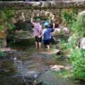
Soon, we emerged to the other side, and were greeted by Nahal Amud, which had been saturated by the winter rains. A new music accompanied our walk now – the music of a flowing stream.

We continued along the stream for a good twenty minutes, through a mixture of sun and shade, crossing on rocks from one side to the next. Soon, we reached a large canopy of shade trees where we decided to stop for a coffee break.
Meet and Greet
After good black coffee, it was time to meet the newer members of our team. Most of our group of 25 was made up of familiar faces, but there were some newcomers – from Israel, Miami, and even Germany. One of the best things about these hikes is the people, so we always take the time to get to know each other before diving into the technical stuff.

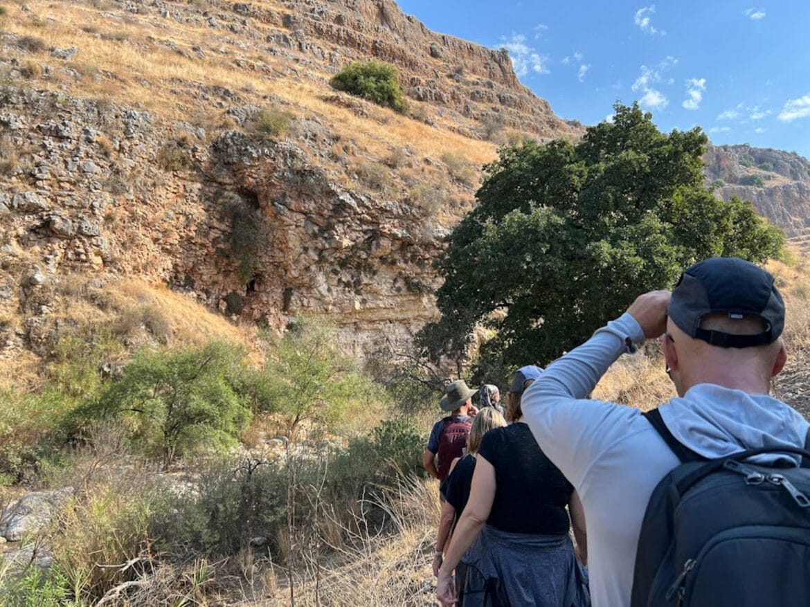
After a short break, we were on our way again, towards the towering canyon walls that make up the sides of Nahal Amud.
Stunning Scenery
We passed by many beautiful and interesting things in Lower Nahal Amud. The views were stunning – cliffs of rock towered above the stream, forming a cozy den for the green plants that grew within. We met the locals: a turtle and a chameleon made their home in the low brush next to the stream. We passed a small spring water pumping station to the side of the path. And as we took in our magnificent surroundings, we made our way up and down over the boulders and rocks of the trail.

Eventually, after losing ourselves in the scenery for several kilometers, we stopped at the Movil HaArtzi (National Water Carrier). This series of pipes was completed in 1962 to carry water from the Sea of Galilee to Rosh HaAyin, and then out to the Negev desert. To pass through Nahal Amud, a reverse siphon technique is used – no special pumps are needed to bring the water down into the valley and back up the other side where it continues to flow along the pipeline.
Nowadays, desalination plants are being developed to help solve Israel’s water problem, turning sea water into fresh water. At some point, it is expected that the water carrier will be used to channel water into the Sea of Galilee rather than out of it.
Rockin’ It
After stopping at the Movil Ha’Artzi, we continued on towards the giant pillar that gives Amud Stream (Pillar Stream) its name. This seemed like the perfect place to stop for lunch. We found our places in the shade of the rocks and enjoyed a second round of coffee on the trail. It was quite a special place to stop and sit. The pillar towered over us, its tippy top seeming to touch the cloud studded sky up above.
After our break, we felt re-energized and ready to go. So we continued along the trail out of the narrow valley of Nahal Amud.

Soon, we reached another important geological formation: Amud Cave. In the early 1960’s, archeologists discovered skeletons and tools of early man in the cave, both Neanderthal and Paelolithic. Now, the cave is closed to entry, so instead of going in, we took a moment to take in the rock walls and wide valley around us. We imagined that the area of Nahal Amud probably looked quite similar tens of thousands of years ago, when early man called it home.
Banana Fields
From here, the path became wide and flat. We were now heading through kibbutz farmland. Our pace picked up as we traversed the trail past rows and rows of banana plants and orange groves.

Most of our group was relieved to have a break from technical walking, and a chance to lose ourselves in conversation while we walked under an overcast sky. After several kilometers of easy walking, we found ourselves just outside the last stop of the day, Ein Nun.
Finishing up with a Spring
Ein Nun has gone through many iterations – once a popular hang-out place, it eventually closed for rehabilitation, then turned into a paid entry site. Now, the grounds are open to the public for free, once more.
Since its reopening, Ein Nun has become quite a popular site. On that afternoon, crowds of school children hung around the manicured grounds surrounding the spring.
It was a bit too cool to jump in, but I took my shoes off to dip my feet into the refreshing waters of the spring. Despite the noise of the crowd, it was very pleasant there. The reflective waters of Ein Nun were filled with images of palm trees and puffy clouds.
After our stop at the spring, it was a fifteen-minute walk further to the end of the eighth segment of the trail at Hilik’s Junction. We all collapsed on the ground in the shade of a grove of trees and enjoyed a luxurious picnic of wine and cheese to celebrate our latest achievement. With one final stretch and a few glasses of wine, we completed the eighth section of our epic journey, through beautiful Lower Nahal Amud.


Hikers’ Notes:
Here’s what you need to know to hike Lower Nahal Amud, the 8th segment of the Israel Trail:
- This is a one way trail.
- This trail is somewhat exposed to the sun. Therefore, it is best hiked during fall, winter, and spring.
- Wear good hiking shoes, and bring plenty of water and sun protection to hike this trail. Swimwear for Ein Nun is optional!
- During the rainy season, some parts of the trail will be flowing with water. Expect several water crossings over stepping stones
- To hike this trail, follow Israel Trail markers the entire way. You can use the Google Earth file for assistance.
Trail map from Amud Anan.
Don’t forget to read my guide to the navigational features in this post before you hit the trail!
Questions? Have you hiked this segment of the Israel Trail at Lower Nahal Amud? Let’s hear about it in the comments!