| Trail Map | ||
| Distance: 11km | Time: 5-6 hours | Difficulty: Strenuous |
| Ascent: 326m |
And we’re back: hiking the third segment of the Israel Trail from Keren Naftali to Nahal Dishon. This varied hike in Northern Israel was probably the easiest stretch of the trail so far.
The third segment began where we left off last time, at the Keren Naftali lookout in Northern Israel. From there, we proceeded through unusual terrain before reaching a wide, flat path in the middle of nowhere. Next, we climbed downhill to reach the main event of the day, the beautiful Dishon Stream.

This segment was lots of fun, and very beautiful…at least in early May when we hiked it. After a tricky and technical beginning, we got to chill out with easy walking on a wide path. The scenery was green, mountainous, and flower filled. And once we left the wide path, the trail took us into a quiet world of hidden spring beauty along a flowing stream.
Here’s how we hiked the third segment of the Israel Trail, from Keren Naftali to Nahl Dishon:
Pickup Game
After a short cab ride from the end of the trail, we picked up the day where we left off last time, at the foot of a pretty path through a beautiful woodland. The trail took us up through the trees, then down on the other side.

This was a pleasant and challenging beginning to a long hike. We enjoyed the red poppies sprouting between the trees, along with the light breeze that kept us cool in the early morning. It was good to be back.
You Take the Good, You Take the Bad
Next, the Israel Trail continued through less than ideal scenery. We crossed behind a huge Rami Levi chicken coop, then proceeded through a semi-industrial area through which packs of cows roamed. As we walked, we kept a close look out for the hard-to-find trail markers.

My eyes were glued to the ground, lest I unwittingly step in a stray cow patty. And suddenly, a cute little turtle crawled out right in front of my feet. I bent down to take a closer look at the little guy, and he immediately retreated into his shell, pulling his head and feet inside. We returned to the task ahead.
Luckily for us, the drab scenery on this part of the trail didn’t last long. Soon, we reached the turnoff to the next part of the trail.
Vineyards, Mountains, and More
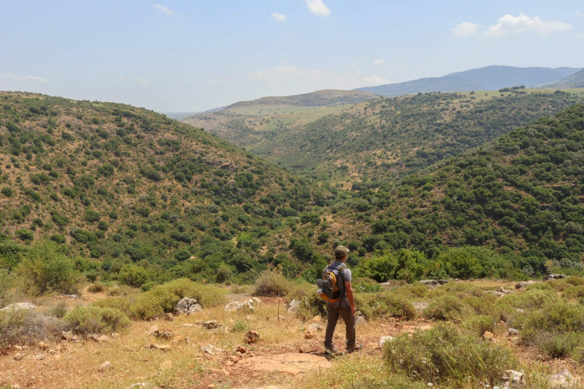
After a short walk on a wide path, we passed rows of beautiful grapevines. Beneath the rolling mountains, it felt like a scene out of French wine country. We were very appreciative of the change in scenery, and we walked along at a fast pace on this straightforward terrain.

The late spring flowers were out in full force. Under a cloud filled sky, large, spiky, purple blossoms popped up from the green grass. The backdrop of rolling, green hills completed the picturesque scene. It was a lovely place to walk on a nice day.
Because this part of the trail was so flat, we zoomed along, completing much of the day’s 14 kilometers in a short period of time.
Always Stop for Coffee
Of course, we weren’t going to skip our morning coffee break, even if it was almost noon by the time we reached a perfect picnic area.
Once we had completed the walk along the flat path, the trail turned to the right along a narrower trail with plenty of trees. We kept our eyes peeled for a good place to sit and found it, under a massive oak tree. There were lots of rocks and gnarly roots to sit on.

We curled up in the shade and poured ourselves hot coffee. Sitting there, gazing out on the quiet hills, it felt like nothing could be more peaceful.
On to the Highlight of the Day
After a relaxing break, we packed up our bags and continued into the Nahal Dishon Nature Reserve. We marveled at the views, then proceeded at a steep descent into the riverbed below. This part of the trail required slow and careful steps along a sharp decline. But before we knew it, we had reached the bottom and the beautiful Dishon Stream.

And who was there to greet us? Another herd of cows sat huddled in the shade right next to the stream, taking refuge under a tree with a massive canopy. We took some photos, then left the crowd to find our own peace and quiet along the river.
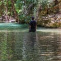
For such a beautiful stream, the Dishon was extraordinarily quiet. We saw one or two small families splashing in the water as we walked, but that was it.
Our Own Peace at Dishon Stream
On this part of the trail, it may have been useful to come equipped with water shoes. There were several water crossings. But rather than take my hiking sneakers off each time, I just found stepping-stones to walk across. (My husband had his water shoes!)
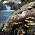
It was beautiful there: shady, cool, and green. Birds chirped in the shadows and the river bubbled along, creating miniature waterfalls in several places.

When we reached one shady spot, I knew I had to stop and take my shoes off. I unlaced my boots, peeled off my socks, and proceeded through the water into the shadows, treading on squishy mud and river walks as I walked. Then, I found a boulder to sit on, my feet dangling into the water. Here, in silence, I took in the magical beauty of nature at a bubbling stream. The music of the flowing water and birdsong filled my ears with a soothing melody.
After sitting there for quite a while, I walked back along the riverbank to the trail, feeling the clusters of dirt and rocks under my feet as I walked. As I laced my shoes back up, I noticed a fading butterfly clinging to a rock in the river. After taking a photo or two, we continued on our journey.

Dishon to the End
From here, we continued on through similar scenery. There were shady patches where the stream bubbled through and stream crossings. We could have spent all day hiking along this one small part of Nahal Dishon.
But not today. Our journey along the third segment of the Israel Trail was almost complete. We would have to return to the Dishon Stream another time. With a quickened pace, we walked until we reached the Aviv water pumping station. After that, it was a short walk to the parking lot where we had parked our car earlier in the day.
The third segment of the Israel Trail had been a great hike, a worthwhile adventure all on its own. From farmland, to green hills, to a beautiful bubbling stream, this hike from Keren Naftali to Nahal Dishon boasted many varieties of natural beauty.


Hikers’ Notes:
Here’s what you need to know to hike this section of the Israel Trail, from Keren Naftali to Nahal Dishon:
- This is a one-way trail. You can call a taxi from Kiryat Shmona to get you back to your car at the end, or park a car at each end.
- This is considered to be a year round trail. Still, it is far more enjoyable on cooler days in the fall, winter, and spring. Nahal Dishon dries up by the end of the summer.
- Suitable for dogs.
- Wear good hiking shoes, and bring plenty of water and a hat to hike this trail. Bring water hiking sandals for the Nahal Dishon part of the trail, especially in the winter and spring, when the water level can be high.
- To follow the trail: Look for Israel Trail markers throughout. It is well marked and easy to follow. Use the Google Earth file in the table at the top of the page for assistance.
Don’t forget to read my guide to the navigational features in this post before you hit the trail!
Trail map from Amud Anan.
Questions? Have you hiked this trail from Keren Naftali to Nahal Dishon? Let’s hear about it in the comments!