
| Trail Map | Terrain View | |
| Distance: 6.6km | Time: 3 hours | Difficulty: Moderate |
Whenever I see green things growing out of rocks it makes me happy.
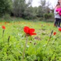
This past Friday, on our hike in the Kedoshim forest near Beit Shemesh (only ten minutes drive!) we saw lots of wild blossoms growing in all sorts of places. There were the usual cyclamens of early winter, along with crocuses and narcissuses in every conceivable stone crack. And moss and clover growing out of dead tree wood.
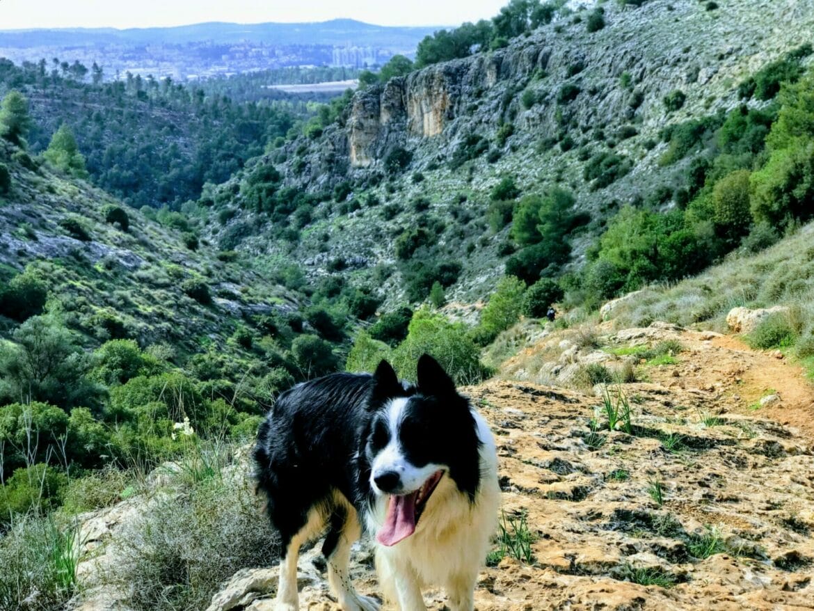
But besides all of that, there was a tremendous green forest, with a stony mountain climb and a long descent through a rocky wild riverbed. Stone cliffs shining in the distance.
Here’s the low down on this six and a half kilometer walk through the wilderness:

The Hike
We started our hike in the Kedoshim Forest at the Anne Frank Memorial, right off of highway 38. It’s a beautiful entrance. I was captivated as we drove down the road, lined by tall trees, towards the memorial cave in a forest. Which was complete with a bonfire ring and picnic area. This wasn’t your ordinary park off the side of the highway. If we had stopped right there and spent our day in this spot, it still would have been amazing.
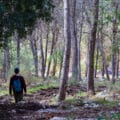
But we had a hike planned for the day. So we found the trailhead for the blue path, and began to hike up Carmila Mountain. The ascent wasn’t very difficult at first. The trail (which is also part of the Israel Trail) is completely tree lined, and although not flat, the climb isn’t steep. We saw hoof tracks in the mud, and wondered what kind of animals we were sharing our trail with.

As the path snaked back and forth, the hill became noticeably steeper. The views at each turn were magnificent – especially one tall rocky cliff in the distance. Green things grew from the ground and on the surrounding mountains. Winter wildflowers poked out of every crevice. And I was happy that we were out at this time of year to see this particular brand of beauty.

Towards the top of the mountain, we climbed over tree trunks and up rocks to stay on the path. We warmed up and shed the light jackets we had brought along for the day. Rolling up our sleeves, we continued until we reached the very top of the climb.
Here we stopped. We stood on the last part of the path that was truly in the forest, surrounded by trees. A few more steps, and we would be up top on a biking and walking path that encircles the peak of the mountain.

The music of chirping birds from every direction called us to sit down and take a break. So we sat here, poured coffee, and listened for a while.
After immersing ourselves in the peace all around (and after a much needed caffeine boost!) we moved on to the top of the mountain.

Here, we turned left onto the black path and followed it halfway around. We watched a few bikers whiz past. This trail was flat and wide, and easy to walk on. The mountain gave us shade, and the dip below revealed fantastic views of the area’s surroundings- rolling green mountains out to the cities in the distance.
We passed a green trail on the right going further up the mountain, but that wasn’t the one we were taking. Soon we came to the next crossroad to the green trail – going down. We could tell that this path would be the wildest of them all. The first rocky descent clued us into the fact that this wasn’t so much a trail as an excellently marked walk through nature.

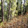
We walked on flat rocks, rocks on a diagonal slant, and broken up rocks. We descended down the Carmila riverbed into the valley below. Down here, it was humid – not hot and wet, but cool and moist. It felt like walking through a river, but there was no river in sight. The strange rock formations that we walked over were clearly shaped by water. Moss and algae grew everywhere. And of course, the flowers.

Some of the rocks were methodically arranged by nature into the shape of an amphitheater. Others seemed perfectly poised in the valley for a hideaway picnic. But the whole way through, we remained fascinated as we turned each corner. Ready to see what surprises nature held in store.

After we walked by a decaying tree trunk filled with clover and moss, we came to the end of this part of the trail. Tall trees climbed up in front of us, and we passed through them back onto the main road – the red trail.
At the very beginning of the hike, we had driven down this road toward the trailhead. I was happy to get a chance to walk along this path. When we drove in by car, I felt like we were zipping past all the beauty. I was right to want to slow down – it was more manicured than the other trail, but no less splendid.

A kilometer or so on this road and we were back at our car. I really wanted to stay there longer. Maybe make a fire in the stone circle on the ground or explore the nearby caves, but we had to go home.
Since it’s only a little more than a half hour from home, I’m sure we’ll be back in the Kedoshim forest soon, looking for new trails to trek. We’ve seen the winter blooms, but who knows what flowers appear here in springtime? Now that we’ve discovered this glorious little treasure, there’s a lot more exploring to do.
Hikers Notes:
Not much to say about this one, except: get up and go! I really never would have believed that this gorgeous trail is only ten minutes from Beit Shemesh (where we lived for three years!!) It’s forty minutes from Tel Aviv and about thirty from Jerusalem.
The trail is moderately difficult only because of the uphill climb at the beginning (200 meter ascent) and the rocky and unsteady walk at the end. But I’m still planning on bringing my kids back here (down to the three year old.) It’s not too long and there is just so much to explore.
Another note: Make sure to park at the Anne Frank Memorial. The trail begins right across from it!
To walk the path in Kedoshim Forest as we walked it, follow the Google Earth file I’ve attached above. Or simply follow the trail – it’s very well marked. Take blue (and also blue and orange for the Israel Trail), left on black, left on green, and left on red. Trail markers are easily visible the whole way through. At the end of the blue trail, there is one section where the markers are painted over in red. I think someone did that just to draw your attention to the fact that it is indeed still the trail. It is kind of a hands and knees climb up for thirty seconds.
And here’s a link to a writeup about this hike in Hebrew.
New! Read this guide to how to use the navigational features in my posts.
*** Update: Someone asked me if this hike can be made shorter for kids. I left a reply in the comments with a suggestion for an easier, one-way version of the hike. Just so you know, we followed my suggestion and did the one way hike ourselves with the kids (and made a bonfire in the stone circle at the end!) It worked perfectly. Follow the instructions in the comments section for a shorter, easier, two car version of this hike.
***Another update: Keep your eyes peeled for the green trail turnoff on the left when you are on the black trail. Some hikers have mentioned that it is easy to miss. (Tip: Use my Google Earth map and you can’t get lost!)
Questions about this? Have you hiked it? Let me know in the comments below!


Thank you
I’ve passed this area so many times and planned on taking the family there.
Is there a route you would recommend with little kids that would make the hike a bit shorter ? Circular or not.
Thanks again
Hey David. Thanks for commenting!
I think the best way to make it shorter for kids would be to take two cars. Park one at the Waze link above. The other you could try to park at Campsite Mount Karmila (type it in just like that in Waze.) That should bring you to the black trail (so you’ll get to skip the uphill of the blue trail). Walk east down the black trail for 1.25 kilometers until you get to the green trail on your right. Make a right onto the green trail, and then continue the hike down the mountain as I described it above. It’ll be easier for little kids this way, but you’ll still need to help them with some of the rocky paths along the way.
If you walk it this way, you’ll end up at a cute picnic area and the memorial site – which is very beautiful.
PLEASE NOTE: I have never tried it this way before, so I hope I’m not misleading you! But if I wanted to make it shorter and easier, this is what I would try. Let me know how it goes!
This looks amazing! Can’t wait to hike it.
Thanks for this! We walked this tour in April 2019. Recommanded.
This was an amazing tiyul! We did it on yom haatzmaut 2019, and the weather was perfect! The only complaint I have is that the turn off onto the green trail is not well marked, and we missed it and had to double back (thank you for the google earth map, that saved us!). I would suggest that you update the description of the trail and stress that while it is easy to see the green turnoff to the right, that the left is easy to miss, and to be sure to look for it.
Thanks for all your help! This site has been very useful to us, and we’ve enjoyed the tiyulim we’ve done so far. Keep up the good work!
Thanks for your comment. I’m happy that to hear that you enjoyed the hike.
I’ve updated the hike description with a note about the green trail turnoff. Sometimes the visibility of trail markers changes through the seasons (overgrowth covering the marker up up, fading), so it’s good to hear updates from hikers who have been on the trail more recently. Thanks!
Thank you very much! We followed these directions exactly and had a great time. We even saw another family there following your directions.
I’m so happy you guys had fun. Thanks for your feedback!
This is my first hike using this site as a guide. Gorgeous wilderness area which is relatively close to Jerusalem. Take plenty of water as the top section on the black trail and part way down the green is very exposed to the sunlight. There really is not a shortened version of this loop, as mentioned take plenty of water for the kids and its totally doable. The (green) trail down is well marked of the left hand side of the fire trail (Black). Garmin sell a Middle East lite GPS file that has this trail well marked. One down side is the garbage left behind from picnickers is kind of shocking in the Anne Frank memorial site. See you on the trails.
Thanks for your comments!
Amazing walk.
Being Chol Moed there were crowds but we were all there to enjoy the beautiful country side.
Flowers everywhere. Trail marking clear.
Thank you Susanne
Thanks for the feedback!
A magical trail filled with challenging climbs, a fun descent, and stunning scenery! So grateful for all the info and the terrific Google Earth map. The Anne Frank Memorial is a really lovely, meaningful way to start and end the hike. Thank you!!
Oh wow! This was so great! And maybe im out of shape but I’d say there were parts up the blue and down the green trails that would make this a ‘strenuous’ hike! So gorgeous, even for the mid-August heat. Thanks!
Thanks for the wonderful feedback!
I did this hike after reading this a couple of years ago and I loved it but I couldn’t remember which one it was……
I just spent 2 hours looking for it for our hike tomorrow!
How does this one compare with the Nahal Sorek and beyond hike?
Hi Daniel,
It’s much easier than the Nahal Sorek hike. Both are very beautiful!
Hi! Can i easily get to the flam winery at the end/along this hike?