

| Trail Map | Terrain View | |
| Distance: 7.2km | Time: 2-3 hours | Difficulty: Moderate - Strenuous |
| Ascent: 367m |
Click here to go straight to hike notes.
I love where I live.
My home turf in the mountains of Gush Etzion is filled with all kinds of beauty: from vineyards, to forests, to ancient stone terraces. This part of the country is rich with history. Its proximity to Jerusalem, Hebron, and Bethlehem means that the area has been well-traveled throughout the ages.
But there’s more to Gush Etzion than history. Beautiful natural springs can be found near every little town. And a long cycling trail encircles the main part of Gush Etzion, providing a perfect pathway from one spring to the next.
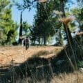
Last week, we hiked a favorite local trail with some friends from Beit Shemesh. It was a gorgeous day, and we wanted to take advantage of the cooler temperatures of Gush Etzion for that morning’s outing.

Our hike took us past two pretty spring pools and out to JumJum, the site of an ancient city where we discovered ritual baths, olive presses, underground caves, and more. And on our way, we were totally absorbed in the beauty of the thick, forested trails.
It was a perfect hike for a morning adventure. Here’s how we walked this trail between two springs and out to the JumJum Ruins:
The Pre-Hike
We pulled into the small town of Bat Ayin and parked our cars. After applying sunscreen and getting our packs together, we followed the road out of Bat Ayin and along the highway towards the trailhead.
This part our walk was rough going – the “trail” along the road was overgrown and slightly thorny. But I explained to our friends that we weren’t yet officially on the hike. And therefore, it was totally okay if it was a little rough around the edges.
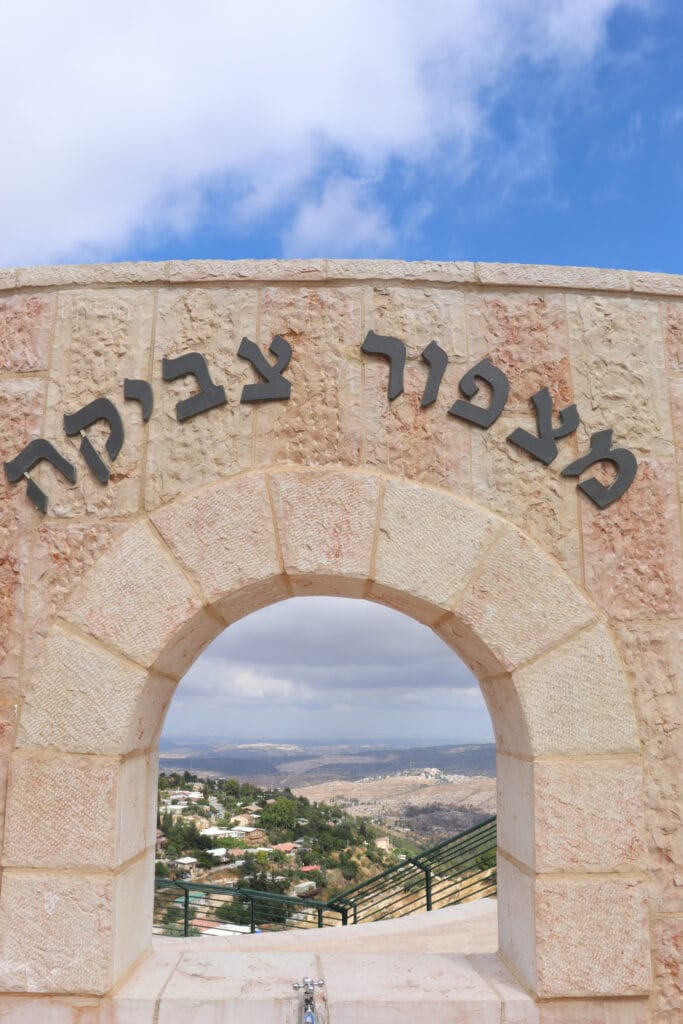
After a few minutes of walking, we reached the Tzvika Lookout and a pretty view out to the surrounding hills, forests, and vineyards. A few moments later, we found the turnoff to the cycling trail and headed down into the forest.
Forests, Caves, and Springs
It was amazing to see how the terrain transitioned so quickly into a shady, peaceful pine forest. This trail was so pleasant that it was hard to pay much attention to our surroundings. We were kept shady, cool, and sheltered from the elements while we lost ourselves in conversation.
After a while, we reached the first landmark on the way: Dubak’s Cave. This hollowed out structure was built by Dov Weinstock, a field explorer for the Gush Etzion Regional Council. We peeked inside and then continued on to Sejma Spring right nearby (also known as Ein Yitzchak).

Ein Sejma is probably the most popular of all of the springs in Gush Etzion. At the site, there is a cool, clear pool next to several wooden picnic benches under a canopy of shade trees. We checked out the main pool, then climbed up to see the source in a little cave. Nearly ripe figs hung from the trees that surrounded the pool.
After stopping for a few minutes, we continued on past the spring along another woodland path.

Sights on the Trail
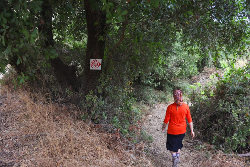
I’ve always loved that next section, along a forested trail between Ein Sejma and Jumjum. It was built for cyclists, which means that it’s narrow, and it’s nestled between thick pine trees. It’s pleasant to walk there at any time of year, even on a hot day. And it’s especially pleasant when you’re headed downhill like we were that morning.
At one point as we were walking, we heard enthusiastic screaming and yelling in the distance. We looked up and saw a man flying across the highway in the air, on the giant zip-line that runs from Deer Land to the other side of the road. We stopped to gawk before continuing on our way.
As we hiked and talked, we breathed in the rich pine scent in the air. Soon, we reached JumJum, a large stone hill that was once an ancient city. From this point and beyond, we experienced a new kind of terrain: forested land that was recently destroyed in one of many local forest fires.

Hirbet JumJum
We climbed up the hill to the tippy top. Our plan was to eat breakfast on the summit of Hirbet JumJum, on top of the ruins of an ancient Second Temple city. First we marveled at the sight of chiseled stone and burnt grass, against the backdrop of forests, vineyards, and a cloud spattered sky.

One of our hiking partners that day is an avid caver. He set right to work checking out every opening in the ground, intent on discovering a hidden passageway. It didn’t take him long to unearth an old ritual bath, a multi chambered dwelling, and what appeared to be an ancient cistern. We followed him into the depths of the ancient city, filled with amazement at the incredible world underground.
After our explorations, we chose a large flat rock on top of JumJum to stop for breakfast. I couldn’t have envisioned a more perfect picnic spot on that cool and cloudy morning.

On the Road Again
Next, we set out back on the path, through a weirdly half singed forest. On one side of the trail, the trees were black and orange. On the other, they remained green and lush. It was kind of sad to see all of the destruction, but we were heartened to know that over time, the land would recover and return to its former beauty.
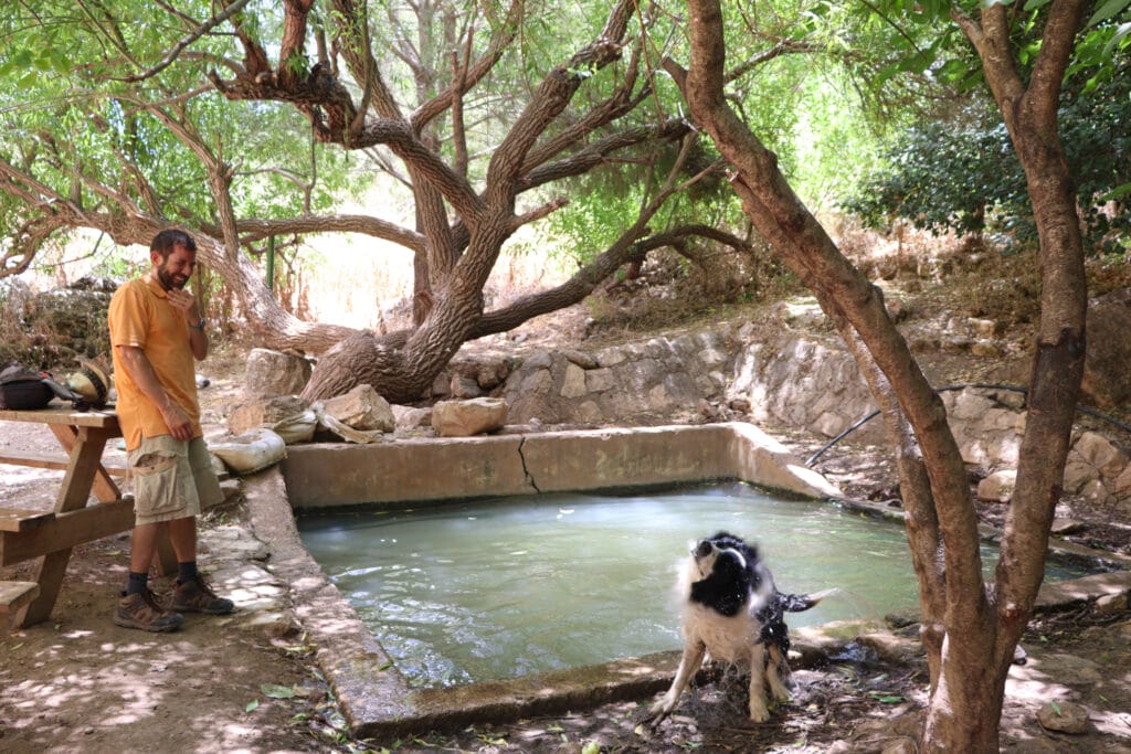
Eventually, we left the forest fire behind altogether and continued our walk along a dirt path towards Ein Livne, my favorite spring in all of Gush Etzion.
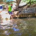
It was beautiful there as usual – the clear spring pool was surrounded by plentiful shade. We sat on the wooden bench to watch our border collie splash around in deep water. While we sat there, we spotted a wild turtle crawling into his hiding spot near the spring.

Soon, we were on our way again, down another forested path. We saw spiky purple wildflowers, an artichoke plant, and wild fennel popping up from the sides of the path. After that it was all uphill, as we climbed back to the trailhead along the sunniest section of the hike. Ten minutes later, we reached the parking lot.
On this off the beaten track trail in Gush Etzion, we had been through forests, vineyards, springs, caves, and antiquities, all on one mid-length trail. Our little local adventure between Bat Ayin Springs and Hirbet JumJum had been a wonderful way to see the best of the local terrain.

Hikers’ Notes:
Here’s what you need to know to hike this trail to two springs and Hirbet JumJum:
- This is an all season trail. Some of the trail is not shaded, so you may want to avoid hiking here in the middle of the day on very hot days.
- Suitable for dogs.
- This trail is in Judea and Samaria. Make sure you carry personal protection and feel comfortable with your safety level before hiking this trail. Do not hike this trail alone.
- This trail does not always follow a well marked path. Therefore, I recommend that you download the Google Earth app onto your phone and use the Google Earth file in the table at the top of this post to follow your location along the trail we took. This is the best way to make sure you stay on the trail we took. Without this tool, you may find it challenging to follow a clear path towards the end of the hike.
- You can use the trail marker gallery and trail map in the table to help you find your way on the trail.
- Wear good walking shoes, a hat, and long pants to hike this trail. Bring plenty of water.
Don’t forget to read my guide to the navigational features in this post before you hit the trail!
Trail map from Amud Anan.
Read more about JumJum here.
Stop by Pat BaMelach bakery and cafe in Gush Etzion after your hike for some delicious sourdough bread and American style baked goods.
Questions? Have you hiked this trail to Bat Ayin Springs and Hirbet JumJum? Let’s hear about it in the comments!


Hi! Thank you for the idea! We did try to do this hike, but unfortunately never found the trail head… We never found the turn off after the Tzvika lookout! The only ‘road” we saw was the one going down to Gavna… Was that the road? We never saw a trail entrance off of it… Can you let me know if we should have taken one of the paths from the parking area just up from the lookout? Was there another paved road, or was the road the one by Gavna? If it was, were we supposed to pass Gavna and keep going? If so, why did you park so far away? We eventually did find Ein Livne, after a few hours of wandering, but none of the other things! Also, a question about your google earth suggestion. What was it supposed to do? We found the trail we were supposed to do on the app, but couldn’t figure out where we were on that map.
All in all it was chalked up to a hot adventure!! (we never got to the water, because there was already a family in the water (who had driven there!), but our dog jumped in!! Thx for any advice!!
Hi Helaine! Sorry you had trouble with this one. It is definitely not easy or well marked.
From where we parked, we walked down the road, past the Tzvika lookout, and made the first left onto a marked bicycle trail. We parked where we parked because that was the closest “normal” parking lot.
The Google Earth map is pretty easy to use once you get the hang of it. If you click on the little arrow on the bottom right, it will show you a blue dot. This is your location. Just line up your location with the marked path and you should be able to stay on track. I would say that figuring out how to work with Google Earth is your best bet for finding your way on this trail. Most of it is marked with bicycle signs (a bike in a little red circle), but the end of it is definitely not!
This sounds amazing! It’s fun just reading about your adventures and it’s awesome that you give information for people to use to try it. Might have to put this on our next trip itinerary 🙂