
| Trail Map | Terrain View | |
| Distance: 6.7km | Time: 3-4 hours | Difficulty: Moderate-Strenuous |
| Ascent: 327m |
Click here to go straight to hike notes.
Friday: that’s hiking day for us. But this past week, we were feeling kind of worn out from a long week of adventuring. We were in the mood for an easy, low key hike with the kids.
We turned to the maps, scoping out our surrounding area for a new trail we had yet to travel. As far as we’re concerned, local hikes are always more relaxed – less driving time equals less stress.
Looking over the map, we remembered one area that we had always loved: Nahal Sansan Nature Reserve. Sitting right in the middle of the reserve stood Mount Sansan, a peak we’d been wanting to climb for a while.

So right then and there, our low-key family hike turned into a low-key family mountain climb, if there is such a thing. From our 5 year old to our 20 year old, we set out on a beautiful journey up to the top of Mount Sansan.
Of course, it wasn’t exactly an easy hike. But the area we walked through was incredibly beautiful. There were vineyards spattered with autumn color, rolling green mountains, and a shady riverbed on the trail. After hiking it, I would have to say that of all the mountain treks in I’ve tried in Israel, Mount Sansan was my favorite.
The kids were actually pretty okay for the most part. There’s nothing that a few renditions of Disney songs won’t get them through.
Here’s how we hiked this 7 kilometer trail up and down Mount Sansan, one of the most beautiful mountains in the Jerusalem Area:
A Walk to a Spring
The trail started at the end of a dust road. We parked our car on the side, packed up our stuff, and started walking.
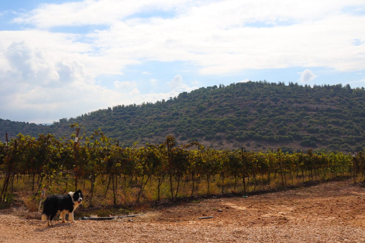
First, we headed downhill, through an area of cultivated natural beauty. Vineyards, green and golden in the early autumn light, lined the path ahead of us.

After a bit of a walk we reached the first landmark on the trail: Ein Geres. Past an entryway overgrown with grape vines and olive branches, we discovered a gorgeous sitting area and two small pools.
One of the springs was full of murky brown water – definitely not a place you’d want to take a dip. But the other pool was crystal clear. It wasn’t full on that mid-November day, but it looked like a great place for a dunk in the springtime.

The kids actually wanted to stop right there and have breakfast. But we had many miles to go. There was no way we were going to hand out the treats just yet. We continued along on the red trail.
Little Tuscany and a Riverbed
On we traveled, past more beautiful vineyards. At this point, the trail began to ascend steadily. And the kids began to get a little worried.
We promised them that the ground would even out soon (we weren’t even close to Mount Sansan yet!). And we assured them that as soon as we found another nice shady spot, we would stop to eat.

On we traveled, following the red trail down rows of grape vines. In the distance, we could see the bottom of the hills up ahead, green and lush in early fall. The ground was kind of muddy, but the scene was incredibly picturesque.
We made a left at the end of the vineyards and reached the entrance to Nahal Sansan Nature Reserve, where we made our way down into the shadows.
Definitely Time for Breakfast
The great thing about riverbeds is that there are always lots of nice flat rocks to stop for a picnic. We found a spot at the foot of the mountains, looking out on rolling hills and a blue sky full of white, puffy clouds. A crisp breeze blew on our faces, making our hot coffee even more enticing. It was the perfect place to stop and eat.
Out came muffins, coffee, and all sorts of other treats. My kids were desperately in need of an energy boost after that short climb up a hill. They ate up their second breakfast, then took turns playing pine cone fetch with the dog. So far, this trail definitely qualified as a low key hike.
At this point I figured that even if we didn’t make it up Mount Sansan, it would still have been a great day.

But of Course, We’re Going Up the Mountain
After our picnic, we were ready to continue, rested and reinvigorated and full of energy for the long trek up ahead.
First, we continued downhill, through beautiful, quiet riverbed scenery. As gorgeous as Nahal Sansan is, we never seem to meet other people when we hike there. For some reason, it’s a less well-known area of natural beauty – which makes it all the more alluring.

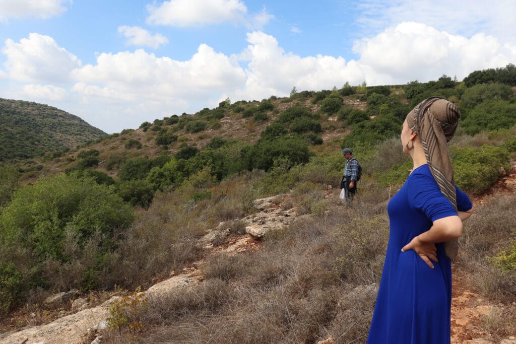
After a little while, we were on the ascent again – this time, up rocky terrain under the shade of cloud cover and occasional trees. It was a beautiful day for a climb like this one. The fog and thick cloud cover intensified the shades of green all around. A ray of sun shone down on Tzur Hadassah, illuminating the town in the distance. Everything just looked kind of perfect.
At the Summit
With a lot of perseverance (and a few piggy back rides) we were nearing the top of the mountain. The last several minutes of the journey were entirely uphill. We climbed up and over grey rocks along the red trail. At long last, we hoisted ourselves up one final time and found ourselves at the summit.

It was gorgeous up there. From our perch atop Mount Sansan, we could see all of the surrounding communities – Tzur Hadassa on one side, Beitar and the rest of Gush Etzion on the other. We could see the valley, green and beautiful down below the mountain. The clouds and sky seemed closer and more dramatic than ever.
Despite any earlier complaints, everyone was happy now. There’s simply no feeling like climbing from the bottom of a mountain to the very top. The kids felt super accomplished that they made it…and they even made sure to climb to the top of a rock pile so they could say that they officially reached the very top.

The Long Journey Back
After a cold drink of water and lots of pictures, we were ready to head back the way we came. We said goodbye to the beautiful views on Mount Sansan and retraced our steps to the trailhead.
The walk back took quite a while and involved plenty of uphill and downhill all over again. Like I said, it was nothing that a few renditions of Disney songs couldn’t get us through.
After many rounds of song and spotting a few wild gazelle amidst the vineyards, we finally made it back to our car.
That morning, we had discovered a beautiful adventure only twenty minutes from our home. At Mount Sansan and Nahal Sansan Nature Reserve, unadulterated, isolated beauty awaits.


Hikers’ Notes:
Here’s what you need to know to take this hike up Mount Sansan:
- Best for fall, winter and spring. The trail is not well shaded.
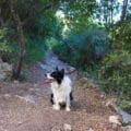
- Suitable for dogs.
- Take a dip in the spring at the beginning of the trail in the springtime and early summer.
- Keep a close eye out for red trail markers. Sometimes they are hard to find.
- Wear good walking shoes and a hat and bring plenty of water. Wear long pants. The trail will be muddy after rainy days. There are some overgrown spots that can be a bit thorny.
- To follow the trail: follow red trail markers the whole way through. When you reach the top of the mountain, turn around and go back the way you came.
- Use the trail marker gallery and the trail map in the table up top to find your way.
Don’t forget to read my guide to the navigational features in this post before you hit the trail!
Trail map from Amud Anan.
Questions? Have you hiked this trail up Mount Sansan? Let’s hear about it in the comments!


We really enjoyed this 3.5 hour hike on a cool day in April. Be aware…part of the route is through an army firing range. The notice is in small print on the trailhead sign with a phone number. When you call you reach an Army operations center. They told us normally you need to apply for a permit to hike here 10 days in advance. Since it was during pesach the range was inactive. Still we needed a permit. They emailed a form to us to fill out and send in. Ten min later we received an official permit from the IDF.
Anyone know how to make this request in advance and if this is an issue in the current matzav?
I was able to find a picture of the starting sign and looks like the number is 02-530-5042
We had the same problem last week. I’ve encountered this before. If you send me an email, I can send you a copy of the form that you need to fill out and send to Central Command.
Albie Hochhauser