

| Trail Map | Terrain View | |
| Distance: 6.5km | Time: 2-3 hours | Difficulty: Moderate |
| Ascent: 191m |
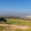
The area around the Sataf Reserve in Jerusalem is enchanting. Blue green pine trees cascade up and down the sides of rolling mountains in an endless expanse. In between the hills, small neighborhoods on the outskirts of Jerusalem pop up: Ein Karem and Beit Zayit to name a couple.
I love looking out at the forests from the top of Mount Eitan at Sataf, but I’ve been wanting to hike through those woods. So, I was thrilled to embark upon this week’s hike around Mount Heret, right nearby.
This woodland hike wasn’t exactly in a valley (the walking loop travels around the summit of a small mountain), but the path did lead through thick pine forests and olive groves.
And as opposed to the main hiking paths in the Sataf area, this six and a half kilometer loop trail is off the beaten track. Which means quieter pathways and untouched nature.
Here’s what we experienced on our hike around Mount Heret:
Look Both Ways!
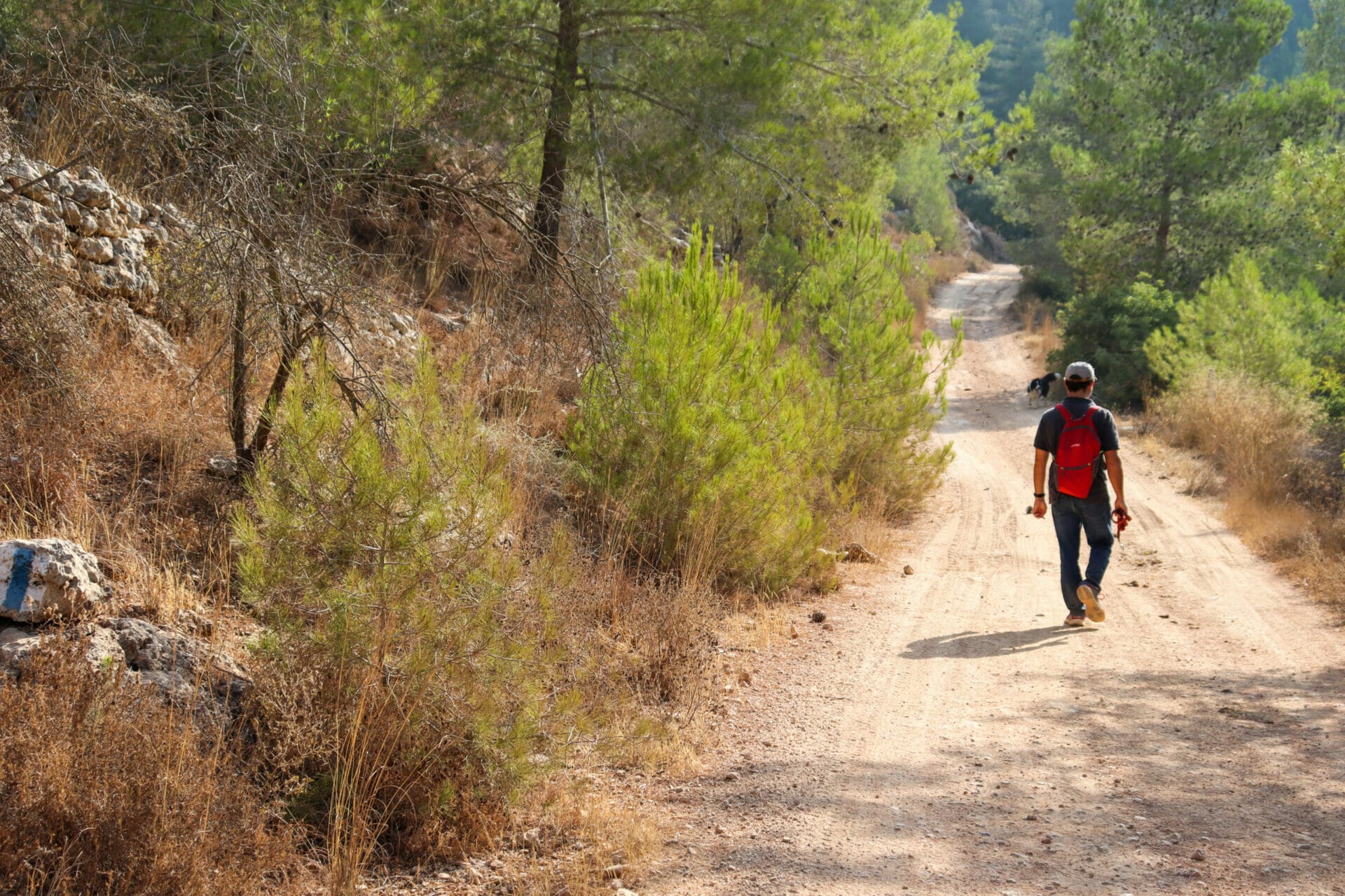
We started the trail in the main Sataf parking lot. From here, we crossed through a traffic circle on a main road and found the trailhead (marked blue) near a set of stone steps.
It was an unlikely place to start a hike – we were literally on a highway. But we scrambled up the steps anyway and followed the blue markers down an overgrown pathway.
This part of the hike was near a highway. So although the only sights around were pine trees and dried grass (classic terrain for an end of summer hike in Israel), we could hear the noise of cars and trucks echoing from down below.

After traveling along the blue trail for ten minutes or so, we reached the real beginning of the trail – a crossroads that leads to a green trail on both sides, the circular loop around Har Heret.
We could have ducked off to the left into the woods at that point to escape the noise from down below, but we decided to follow the green trail forward. It would take longer to get into the silence of nature that way, but at least we’d pass the later part of the hike in quiet solitude.
From Pine Forests to Olive Groves
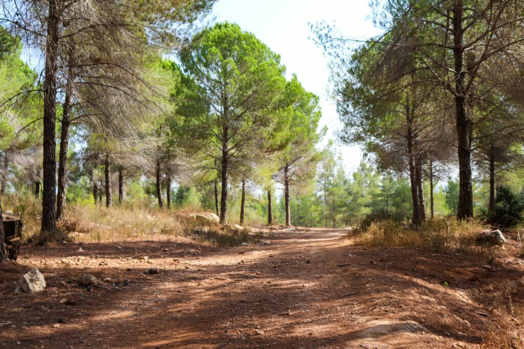
The smell of summer pine was thick in the air. The green trail around Har Heret reminded me a lot of the path around Mount Eitan. It was a bit more rugged, but the path was wide and flat and surrounded on all sides by tall evergreens.
On that summer day, the path was just shady enough to prevent major sun exposure. In the early morning, the tall trees still kept the sun’s harsh rays off half of the trail.
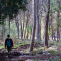
As we walked, the path slowly curved away from the highway zone. The traffic noise faded, and we found ourselves winding our way through a silent pine forest. We watched as a small flock of birds went soaring out of the woods.
After some time, we saw an olive tree on the side of the path. First one, then three, then a whole grove. The trail wove its way through an orchard of olives, all hanging heavy with ripening fruits. The twisty, gnarly bark and lazy branches formed a perfect little tunnel along the path.

In Search of a Spring
After making our way through the olive grove, we approached a turnoff to the black trail. This pathway led up to the top of the mountain next to an old, out of use quarry, before connecting back to the green trail to complete the loop.
We knew we had to take this path. (Right now, the full green circle around Har Heret is obstructed by construction, so the black trail is the only good way to complete the loop.). But before going up, we wanted to head out on the green trail just a little bit further. Word on the street was that there was a natural spring just up ahead.

On we trekked in search of the spring. After walking for a while longer, we saw a trail sign to Heret Spring (Ein Heret). It looked a bit ramshackle and overgrown. And it was safe to assume that the spring would be dry in September. But we wanted to find it anyway.
So, we plowed through the tall reeds and down a set of hidden steps towards the spring.
Make Your Own Memories
And we found it. A really nice little pool with a beautiful shaded area to sit nearby.
Which was totally dry.
Since it was late September, a dry spring was to be expected. We would have to return after the winter rains to see what Ein Heret looked like in the springtime.
We returned back the way we came, up the steps and on the green trail, back towards black. Before climbing up to the quarry, we found a peaceful spot under the trees to stop for a break.

Sitting there in the cool, quiet, silence of a pine forest – it’s really our favorite part of the whole week. When we stop and sit in silence in the middle of nature, time slows down. Our senses tune into the small details – the breeze, the way the sky is that day, the rocks and leaves on the ground. The cold coffee in a cup. It becomes a multi -sensory memory to tuck away and carry through regular days.
Moving on Up
After taking as long of a break as we could manage, we were on the move again, up through the pine forest and onto the top of Mount Heret. The climb wasn’t very difficult. At the top, we were rewarded with a super cool view down into a giant unused quarry. Maybe not the most beautiful, but still a spectacular sight.
As we walked along the side of the quarry, we followed the black trail all the way to the end, where the green path led back down through the trees.

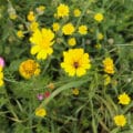
From here on in, the views around were more or less the same – pine trees, then mountain views. And occasionally a fall squill flower popping up from the dry grass.
Twenty minutes on the green trail and then we turned onto to blue again- from here we returned back along the path we started on, past pomegranate trees laden with fruit and towards the trailhead.
Mount Heret – it seemed like it would be just another walk through the woods. But maybe there’s no such thing as just another walk through the woods.
Pine forests, olive groves, sights and sounds of serenity in nature, all just minutes from Jerusalem – this is one natural landscape you can’t take for granted.


Hikers’ Notes:
Here’s what you need to know to hike this trail at Mount Heret:
- This is an all season trail. That said, there is plenty of sun. Avoid this trail on very hot days in the summertime.
- Suitable for dogs.
- This is a circular trail.
- Finding the trailhead can be a challenge. From the parking at Sataf, walk back towards the main road. The trail begins on the other side of the traffic circle (about a five minute walk away from parking). You will see a trail marker and a set of little stone steps where the trail begins (See trail marker gallery for assistance).
- Note: If you take the bus, you will be dropped off right by the trailhead!!! Do not continue to walk to the Sataf parking lot as you will just have to backtrack. See the trailmarker gallery to find the trailhead as soon as you get off the bus.
- To follow the trail: Walk straight along the blue trail. When blue turns to green, continue straight (do not turn left). Follow green, keeping a close eye out for trail markers. After the olive grove, you will pass a black trail on your left. Continue on until you reach the spring (Ein Heret) to the right of the trail. (This spring is not full during the summer months). From here, either turn left onto the unmarked trail just up ahead, or backtrack to the black trail and turn onto that. (The unmarked trail will hit the black trail after a few minutes.). Follow the black trail until you reach the green trail. Then, follow the green trail to the left (continuing across the mountain), keeping a close eye out for trail markers. When you reach the blue trail, make a right to follow it back to your car.
- Although signs on this hike refer to the "Sovev Har Heret" or Mount Heret Loop Trail, I do not see that a green loop currently exists. Best to follow the directions outlined above.
- Use the trail marker gallery, trail map, and Google Earth file for assistance. Pay close attention to trailmarkers as you hike.
- Wear sun protection and good walking shoes to hike this trail.
Don’t forget to read my guide to the navigational features in this post before you hit the trail!
Trail map from Amud Anan.
Questios? Have you hiked at Mount Heret? Let’s hear it in the comments below!


We followed the trail until it bent away from the road. We went from Pine forests to Olive groves along the mountain path. Perhaps the link to the map is not correct, because it says route 1 on it, but we did originally walk along the road. Anyway, we followed the green trail around.
At some point, we could follow the green trail or go over a very steep hill (a road) — we took the green trail to the right. We seemed to be moving westward, but we ended up in what the Taxi driver said was Mevaseret Tzion (but might have been: Ma’Oz Tiona. It was three km from Sataf, and we took the same cab back to our car. The construction at the end of the green trail is a huge number of buildings, apartments, etc, and hence the trail then winds downhill to Moza.
Not sure where we went wrong (or if the trail is now blocked by the new development).
Thanks for your comments. I really appreciate your feedback. This is kind of a hard to follow trail (off the beaten track).
Did you use the trail marker gallery and the trail map in the table at the top of the hike page? Or the Google Earth file?
You may have missed the turnoff to the black trail (it’s before the spring – you can see a picture of it in the trail marker gallery) which takes you up a steep hill, past a quarry, and then hits the green trail as it loops back on the other side.
You are right that if you continue on the green trail (rather than turning on to black), you reach a lot of construction which makes it impossible to take the full green loop as it once existed. That’s why we had to shorten it by crossing through on the black trail.
Hope you had fun anyway 🙂
Hey! As always, love following your hikes on a random day off 🙂 so update as of October 2021: the green trail construction appears to have ended. We decided to follow the green loop (the first left that you said not to) but then we followed your instructions afterward (black to the end of the quarry, etc). Where the black trail ended we made a left at the green but it led us to Mevaseret; there was also another green loop we were hesitant to follow because there was a felled tree/pole (I’ll send you pics later if you want) and a place where it looked like the green ran to the blue but the blue was completely rubbed off. So either we made a wrong turn or they must be changing things! Either way, figured we’d post to warn people.
Thank you!
So it sounds like you made a left onto the green trail instead of continuing straight, then reached the black trail which took you across the quarry, then made a left onto the green trail again? If so, it makes sense that you would end up in Mevaseret rather than completing the circle. Take a look at the trail map and you can see what I mean.
Either way, I think I need to get back there so I can check things out and update the post. Thank you so much for the feedback and helpful info!
Thanks for posting this trail! I walked it yesterday with one of my daughters – and it was a very nice hike.
There’s one section (around 100 m long) at the end that is a bit steep and covered in broken glass (you can avoid it by walking along the road if you want). Besides that all was good – olive grooves, lots of acorns, some other interesting trees, and even a few rakefets.
Stats:
6.6 km
1 hr, 45 min
173 m elevation gain
Sounds wonderful (minus the broken glass!)
Thanks for your comments!