| Trail Map | Terrain View | |
| Distance: 13.5km | Time: 5-6 hours | Difficulty: Advanced |
| Ascent: 520m |
Nahal Zohar – we really wanted to hike it. From the pictures we had seen, it was an absolutely beautiful trail, filled with the most impressive layers of chalk white rock stacked up to form a tall canyon.
But it was supposed to be a one-way hike. And we have just one car – none to leave at a second lot. So, we studied the map with dedication until we figured out a way to make Nahal Zohar a circular trail that would take us right back to where we started.
By combining another dry riverbed, Nahal Hemar, with Nahal Zohar, we created a hike that traversed two beautiful desert canyons. It was going to be on the long side (13 kilometers with a mountain ascent in the middle), so we set it aside for a full day of hiking.

And last week, we finally made it!
Turns out, combining Nahal Hemar with Nahal Zohar resulted in an epic hike through all kinds of desert terrain. We saw natural asphalt, impressive views, and climbed through an alabaster canyon. And we also came face to face with a herd of ibex on the trail.
Here’s what this 13 kilometer hike through the Judean Desert was like:
All Roads Lead to Nowhere
We parked at a gas station in Neve Zohar, then followed the highway towards the trailhead. We were kind of in the middle of nowhere. And since this wasn’t the area that attracted us to the hike, we expected it to be sort of blah.

But after only a few minutes of walking on the trail, a wide expanse of desert opened up before us. Mountains of red and white rock spread out on all sides. And we followed the trail that took us right through the rock walls.
Not Blah
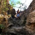
The first thing we noticed were the strange looking rock formations at our feet. Rather than the usual chalky white stone or red jagged, the sides of the canyon were filled with black rock full of white stones. It looked almost like a manmade road.
In fact, it was naturally occurring asphalt – used once upon a time to line earthenware dishes. This unusual rock is what gave Nahal Hemer its name.

From here, we continued through the canyon towards a shady spot – a cluster of trees right in the middle of the desert. Although we weren’t ready to eat yet, it was a particularly beautiful place to stop and enjoy the unadulterated desert silence. So, we took out a couple of pears and stopped for a break.
On to Boulder Fields
After taking in the quiet of Nahal Hemar, we got back on track again, following the blue trail through the canyon towards a field of huge boulders.
Large rocks were strewn all around, like playthings of a giant.

We had fun scaling a few of the boulders. But some were too large and round to even try to climb.
Between the boulders, plants grew, nourished by the water that rushes through Nahal Hemar during flash flood season. We were enjoying the incredible scenery and ample shade.

And then the green trail appeared, ready to take us up and out of the canyon, towards a steep climb up Mount Hemar.
Climb Every Mountain
Suddenly it was sunny. And the ascent was challenging. We put one foot in front of the other, plowing up the side of the mountain.

As our position rose, the views out to the desert became more and more spectacular. But it was only once we stopped at the first plateau that we could really appreciate our surroundings.
In the distance, we could just barely see Neve Zohar, where we began the hike. Down below, Nahal Hemar was visible on one side, a channel weaving its way through the mountain. And even further in the distance, the Dead Sea gleamed bright blue and flat under the open sky.

We were tempted to stop right there and have breakfast (lunch?), but it was pretty windy at the top. So, we plowed on along the side of the mountain, ascending ever so slightly with the green path.
At last, after one final steep incline, we had reached the very top and were ready to climb back down again.
Towards the Main Event
This descent wasn’t the most exciting part of the hike. We made our way slowly down a slanted field of little stones, towards the highway down below.
Keeping our eyes peeled for green trail markers, we followed them carefully to stay on the right track. Then all of a sudden, the green trail markers strayed up and to the left in the exact place where we knew we had to make a right towards Nahal Zohar (we could see the sign right there on the other side of the highway).
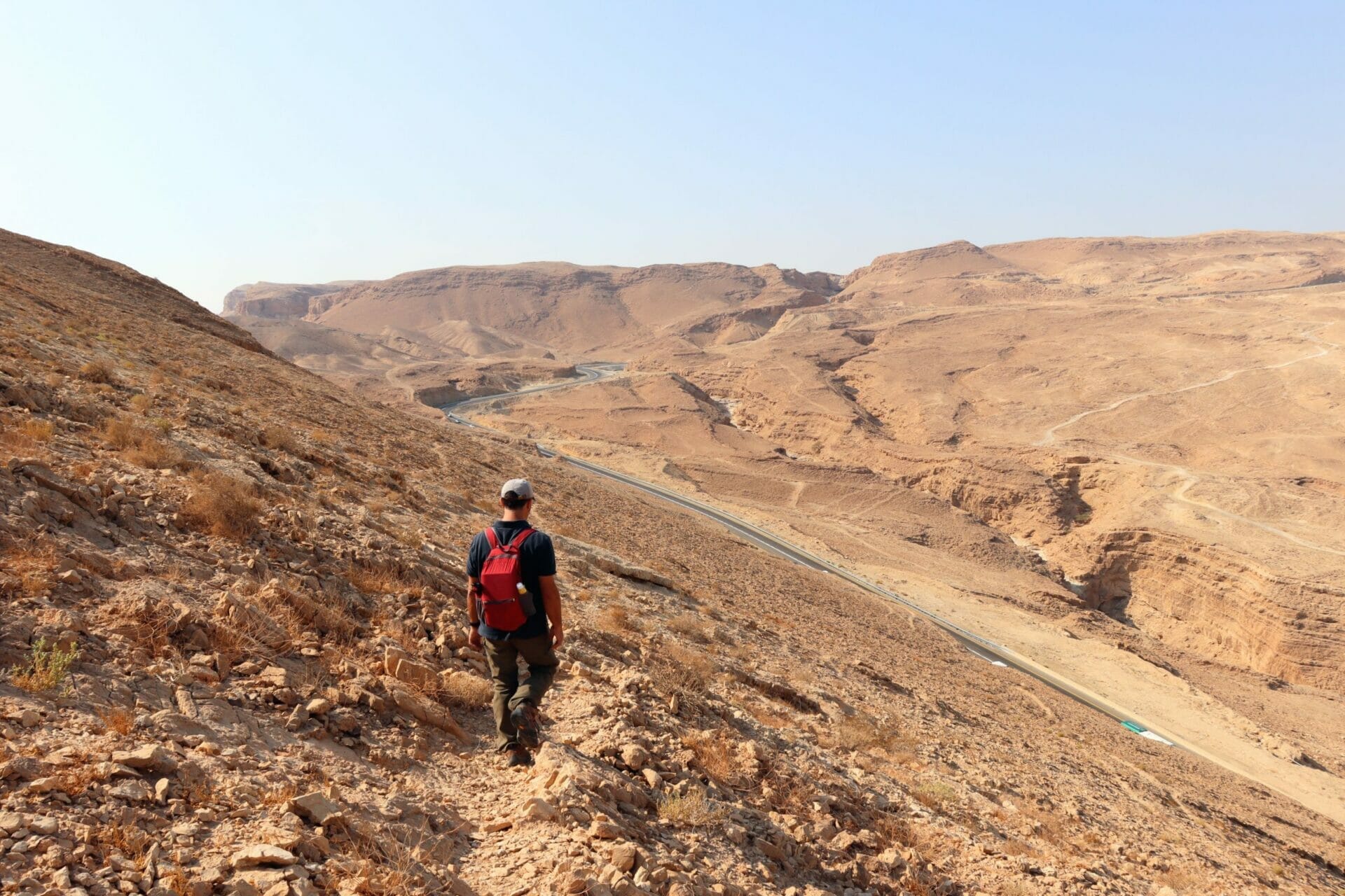
So, rather than follow our usual advice about trail markers in the desert, we broke the rules and made a quick right towards the Nahal Zohar trailhead, crossed the highway, and followed the trail into the canyon.
Completely Out of This World
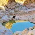
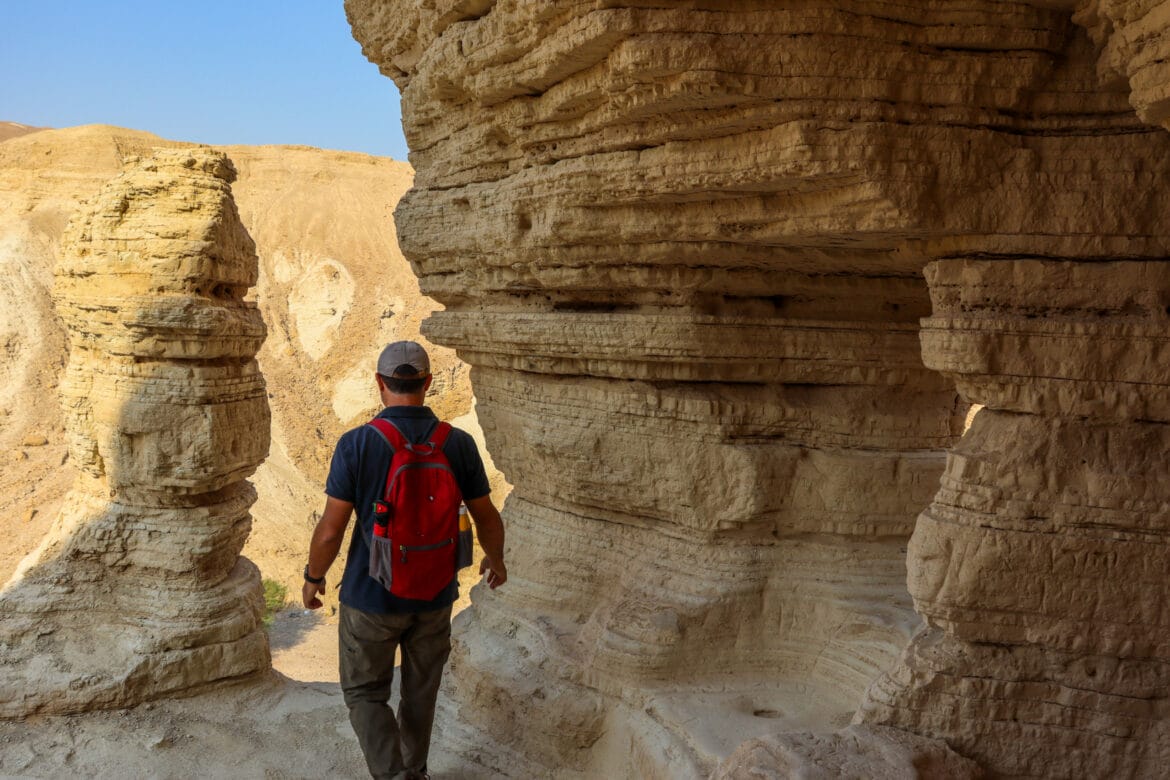
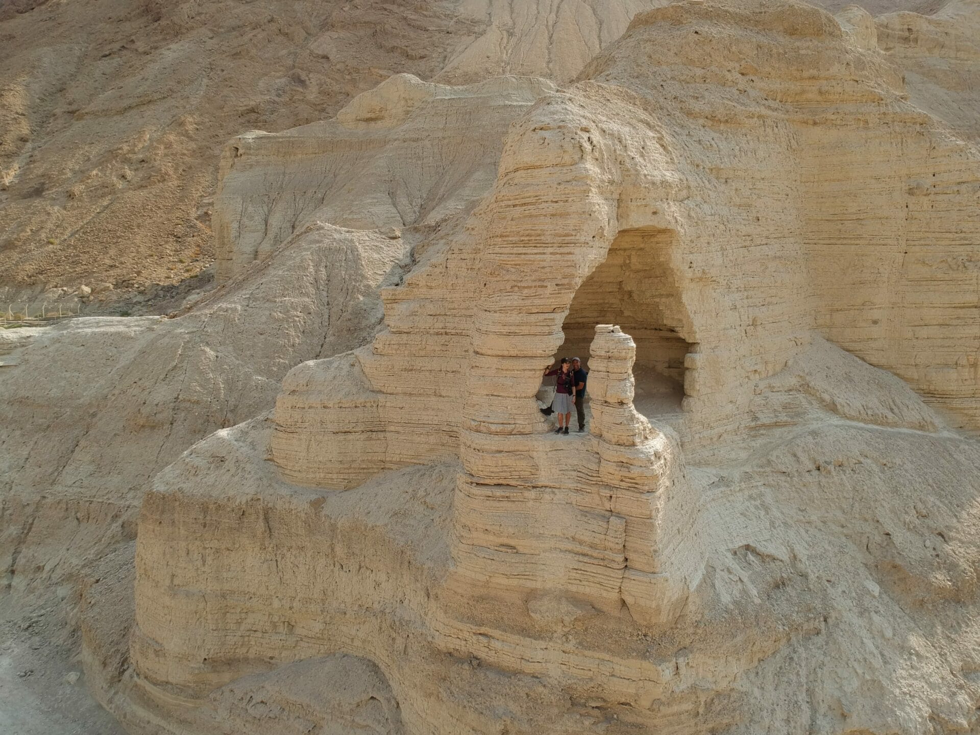
The first five minutes of the trail wasn’t much different from what we were climbing through moments before. But after a few minutes, an incredible series of white rock towers stretched out before us.
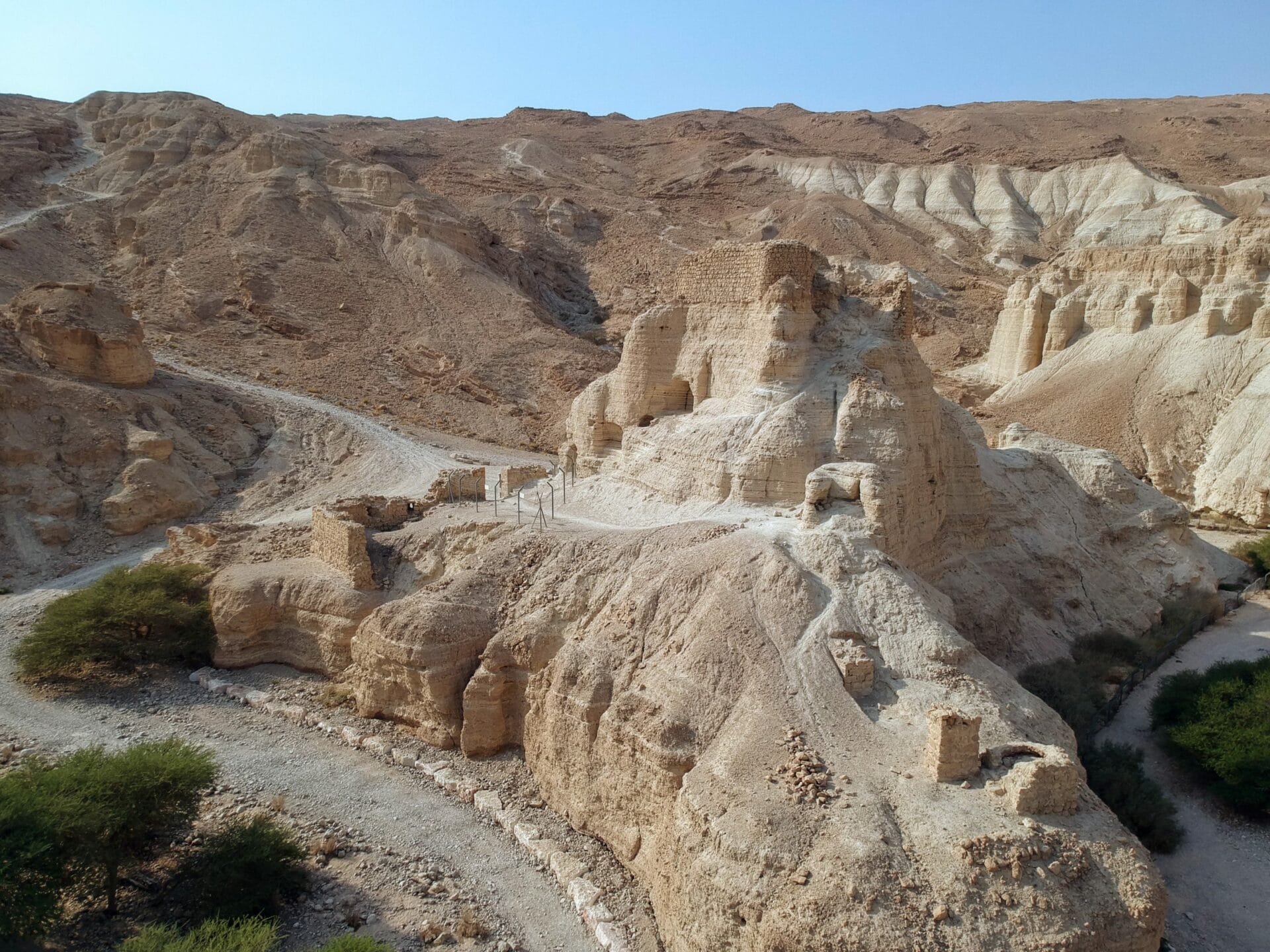
Down below, we could see alabaster walls of smooth stone in all kinds of beautiful formations. Right in the middle of the canyon sat an impressive fortress, so out of place yet seeming to belong.
We figured the view couldn’t get much better, so we found a shelf of white stone in the shade and sat down for a very late breakfast.
Save the Best for Last
It was late in the day, and we still had all of Nahal Zohar to tackle. But after eating, we really wanted to stop and explore the area around the fortress.

Up a white ramp on the side of the mountain sat a little cave, with natural windows out to the world. From this viewpoint, we could see Zohar Fortress on one side and the riverbed channel on the other.
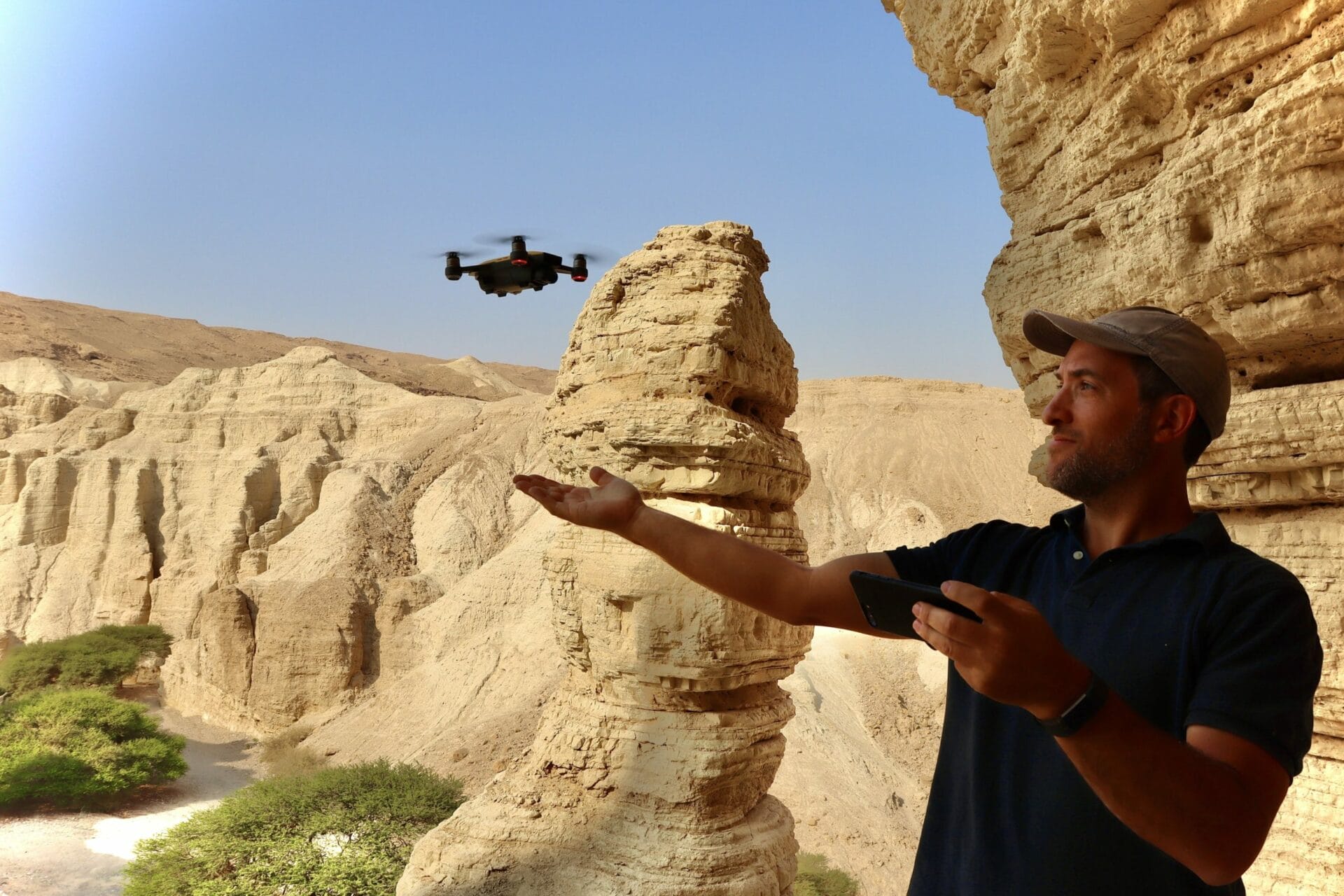
If the drone was coming out of the bag that day, this was the place. My husband spent ten minutes flying his toy at every angle. Then we packed up and made our way down towards the inside of the canyon.
Climbing Fun and Desert Friends
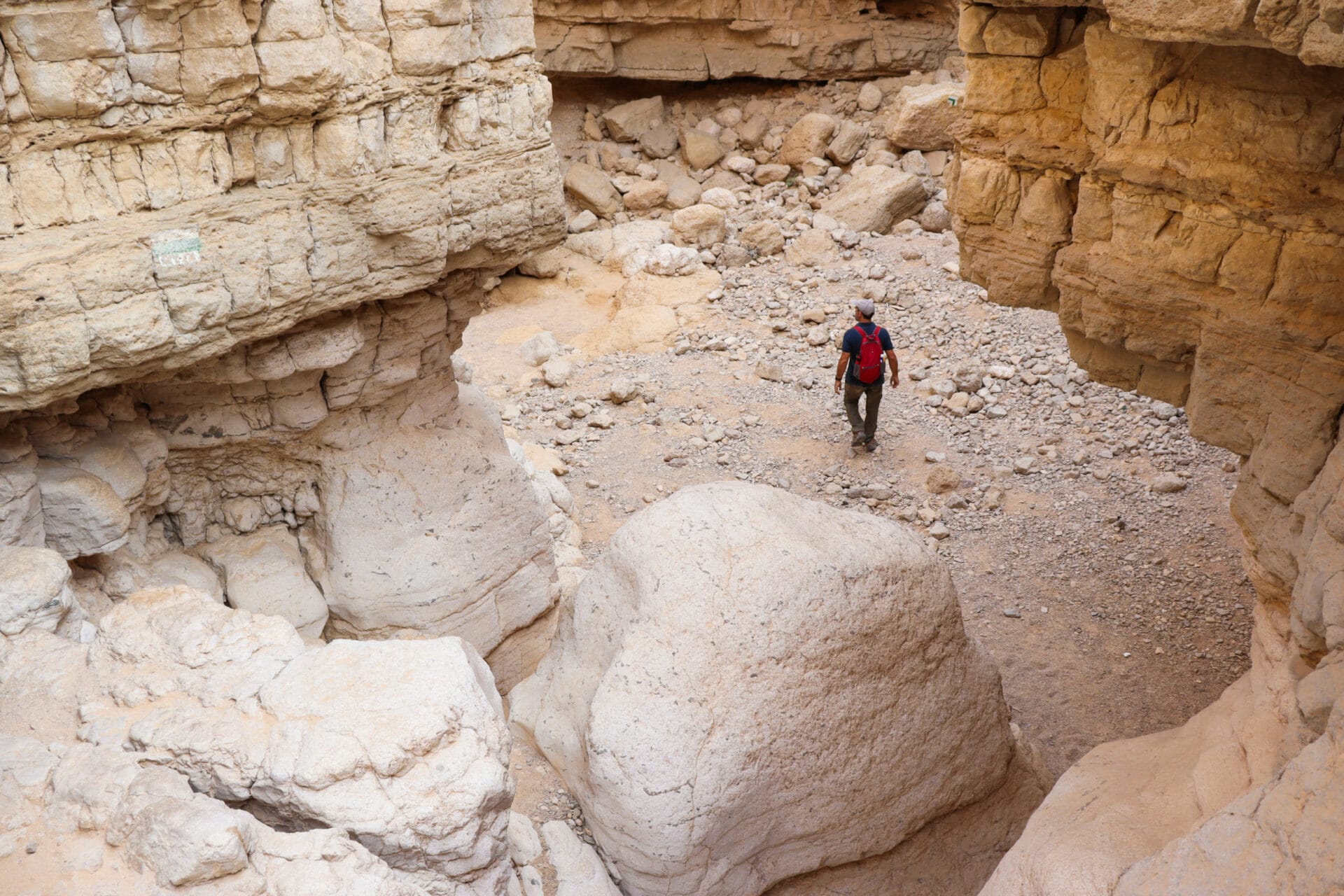
I really love climbing down rock walls through riverbed canyons. And Nahal Zohar did not disappoint.
We headed down through the riverbed, using our hands and feet to stay balanced as we descended. The climb down wasn’t too hard. And the play of light and shadow made the scenery all around really special.
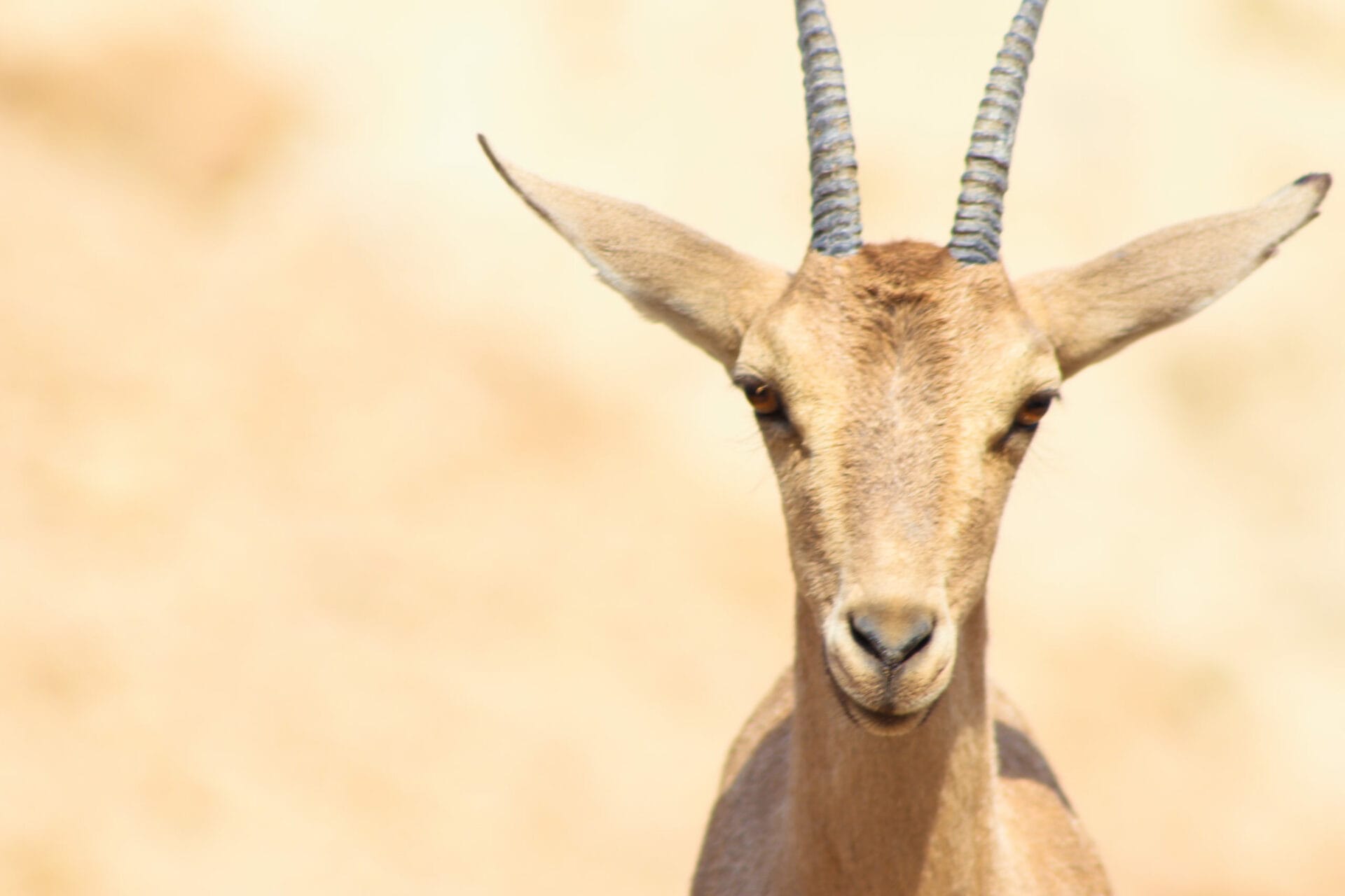
As we made our way through, we noticed something moving in the distance. Out of the shadows, one lone ibex appeared on a boulder, almost blending in color with the rock right behind him.
I moved closer, my camera ready. The ibex began to scurry away, and I thought I’d lost a photo opp. But then a whole family of ibex appeared, at least twenty animals in a pack in the middle of the canyon.

We hung out with them for a little while before continuing on our way.
Goodbye, Nahal Zohar
From here on in, the unbelievable scenery continued to impress us. We saw clusters of trees in the middle of the dry desert. And walls of soft rock seemed to drip down the side of the mountain in waves.
Then, the canyon opened up and disappeared, revealing only a massive highway overpass and flat desert scenery up ahead.
We finished up the last part of the trail with a major sense of accomplishment. That day, we had hiked through two totally different canyons and climbed a steep hill. We had seen a beautiful white fortress, chalky rock caves, and a family of ibex.
It had been a great day for hiking, yet again. No matter how frequently we venture out to explore the Land of Israel, we still seem to make incredible discoveries each and every time.

Hikers’ Notes:
Here’s what you need to know about this trail:
- Best suited to fall, winter, and spring.
- Bring plenty of water and sun protection.
- Not good for dogs.
- Make sure to keep correct trail markers in sight the whole way through.
- Trail markers gallery, Google Earth file, and trail map are in the table up top.
- Trail to follow: blue, green red, blue.
- You will have to leave the trail to cross the highway. Look for the sign leading down to Nahal Zohar and cross there. You can see an image of the site in the trail marker gallery up above.
- At Nahal Zohar, you’ll see a blue trail and a green trail. Take green! Look for the green trail markers, and you should find them.
- The last part of the trail is from the canyon back to the car is hard to follow. The trail markers are a bit scattered. But you should be able to see the gas station and make your way back.
- This is a strenuous trail for fit hikers only.
Make sure to read my guide to the navigational features in this post before you hit the trail!
Trail map from Amud Anan.
Questions about this trail? Tips for fellow hikers? Let’s hear all about it in the comments below!
Hiking can be dangerous and is done entirely at your own risk. Information is provided free of charge; it is each hiker’s responsibility to check it and navigate using a map and compass.