

| Trail Map | ||
| Distance: 5.1km | Time: 3.5 hours | Difficulty: Strenuous |
| Ascent: 457m |
Click here to go straight to hike notes.
The winter rains are here in full force. And with them, the Jordan Valley has begun to undergo a slow transformation. At Sartava Reserve in the Jordan Valley, desert-like hills slowly develop a greenish fuzz. As the rains sink in, the fuzz turns into a deep green coat of grass. And then come the flowers.
Yesterday, after a week full of rain, we decided to take advantage of a sunny day to go witness the winter wonders at Sartava. This hike up this mountain is a challenging one: steep, but quick.
Rather than drive all the way to the Shomron for a short foray up and down a mountain, we decided to follow a longer loop trail that would take us down into the valley, then on a slow ascent towards the top of Sartava. This way, we would get to enjoy the rainy-season scenery of the area around Sartava for several hours.
So, what does Sartava look like in late January? Well, its…spectacular.
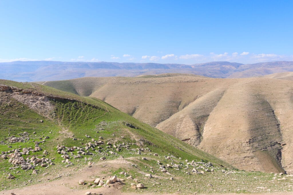
But the crazy thing is that it only gets more beautiful as the season progresses. Yesterday, we got to see dramatic inclines and sharp edges around Sartava coated in a thin layer of green. In a month’s time, the entire area will come alive with thick green growth and colorful flowers.
We’ll just have to go back again in March.
Still, we thoroughly enjoyed the physical challenge, beauty, and history of Sartava on our journey. Here’s what we saw on this this 5 kilometer loop trail at Sartava:
Getting There
We drove through the Shomron, admiring the green growth that had started to transform the usually dry landscape. After a quick turnaround at the settlement of Massua (torch, in English), we began the careful climb up the long, steep road to Sartava Reserve.
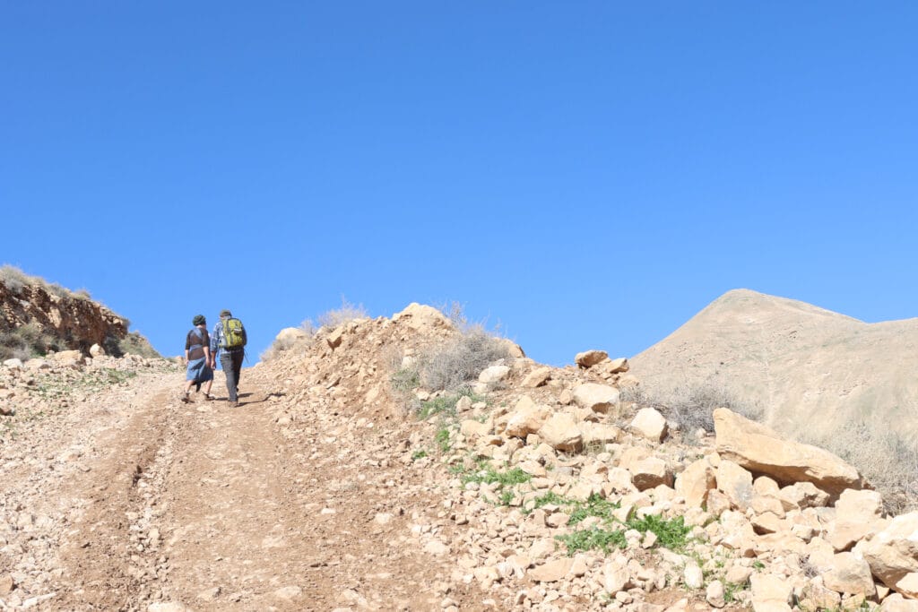
Soon, we reached the parking lot. We got out of the car and began backtracking along the road towards the red trail. Then, we set out on a climb down into the valley.

One of the coolest things about the Sartava Reserve is that you can actually see all of the trails from almost any vantage point. Narrow ridges snake their way into the valley, and back up the mountain. Many of these clearly defined lines are the walking trails that make their way around the reserve and up to the mountain peak.
When we stopped to look out on our trail for the day, we noticed a couple of gazelles hopping around in the valley. We quickly climbed down towards them, but by the time we reached their grazing spot they were gone, leaving only fresh footprints in the mud.
It’s All Uphill
From that low point in the valley, we began our long, slow ascent towards Sartava. Up we traveled, on a relatively straightforward path. The air was cold, and we enjoyed the breeze that cooled us as we climbed. Not only that, but there was plenty to look at whenever we needed a break.
From our perch on the side of the mountain, we could see the contrast between desert-like scenery and green terrain of the Shomron. The views were simply spectacular.
When we peered down close to the ground, we noticed ladybugs and butterflies making their way between diminutive purple flowers. Between the greenery, shiny flint stones lay scattered on the dusty pathway.
The Place to Stop Before the Place to Stop
After a long journey filled with chatter, we reached the final ascent towards Sartava. Right at the bottom, there was a large patch of greenery interspersed with flat stones. Just beyond this patch of grass, we could see a beautiful panoramic view out to the surrounding area.
True, we hadn’t reached the top of Sartava yet. But this seemed like an ideal place to stop for coffee and breakfast. And it was almost noon. We headed on over and chose a few flat rocks to sit on.

While we were sipping hot coffee and eating apple muffins, a shepherd rounded the bend with his large flock of sheep. They made their way over the side of the mountain, baa-ing and grazing as they walked. Considering the historical importance of Sartava (more about that later), this flock of sheep made us feel like we had taken a journey into the past. We watched as they ate their fill, and then we had a short conversation with the shepherd before they all went on their way.
The Final Ascent
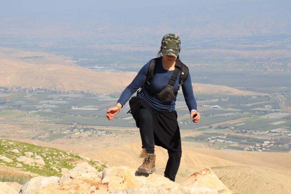
Refreshed and reinvigorated, we strapped on our packs and headed up the final ascent, to the very top of Mount Sartava. The climb was steep, but not very long. Before we knew it, we were taking in the magnificent views from the top.

Aside from the views, we also noticed the remains of an ancient fortress at the top of Sartava. Crumbled pottery lay in heaps along the path. In the distance, we could see out to the Jordan Valley and towards Mount HaKochav further south. It was a foggy day, but had it been clear, we may have been able to see straight out to Jerusalem.
Sartava: What is this Place?
So, what was the importance of Sartava in Jewish history?
In ancient times, Jews had a system for determining the calendar, the holidays, and the changing months. Around Rosh Chodesh time (the new month), watchmen would go out nightly, waiting for first sight of the new moon. When the moon was spotted by witnesses from the Sanhedrin, a beacon would be lit at Mount of Olives in Jerusalem, to serve as a signal to the surrounding communities that the new month had arrived.
According to the Jewish Mishna, Sartava was the first peak near Jerusalem to see the signal from the Mount of Olives. Jews atop Sartava would spread word of the new moon by lighting a beacon of their own. With this careful attention to the passing of time, the nation would be able to correctly determine their calendar and holidays. Even Jews on the other side of the Jordan river would have been able to see the lighted torch and set their calendars accordingly.
So what was a fortress doing on top of Sartava? This mountain was also located in a strategic position, right on the edge of the Jordan Valley and Israel. Therefore, a fortress was built on Sartava during the Hasmonean era. Towards the end of the Second Temple Period, King Herod the Great restructured the fortress (along with others throughout the Land of Israel). Ultimately, he imprisoned his wife and two sons in this fortress on top of Sartava, where they were eventually buried.

Although it seemed impenetrable, the Sartava fortress was conquered by the Romans and later destroyed in an earthquake.
All in a Day’s Adventure
After taking in the sights from the top of the mountain, we began our descent. This time, we were headed down on an extremely steep and slippery slope which would lead us directly back to the road.
It took some time to navigate our way down. For starters, the footing was tricky. But there was also a lot to distract us on the way. We picked up handles and spouts that laid among the remains of other cracked pottery. There were yellow and brown butterflies flitting between purple flowers. And big shiny rocks caught our eye.
Eventually, we had descended away from the steepest part of the path and were walking on a more comfortable incline down to the road below. A few minutes later, we were back at the trailhead.
Our trip to Sartava that day included everything one could want out of a hike: intense beauty, physical exertion, and an incredible story. This impressive mountaintop trail in the Jordan Valley is one that every hiker in Israel should add to their bucket list.

Hikers’ Notes:
Here’s what you need to know to hike this trail at Mount Sartava:
- This trail is best for cooler days in fall, winter, or spring. In the summer months, you can climb Sartava at sunrise.
- Sartava is located in Judea and Samaria. Don't hike it alone and make sure you feel comfortable with your level of personal safety before you hit the trail.
- Wear good hiking shoes and bring plenty of water and a hat to hike this trail.
- Dogs are allowed.
- Sartava is located in a "Shetach Aish" (an army firing zone). Officially, you are supposed to call in advance for permission to hike or hike on the weekend. Unofficially, many people hike this trail all the time, without advance permission. Here is the number to call for permission: 02-5305041. Make sure to call at least three days in advance.
- You can hike this trail the way it's listed, or just head straight up and back down the green trail for a shorter and more direct hike.
- Use the trail map, trail marker gallery, and Google Earth file to find your way on the trail.
- To follow the trail as we took it: Park in the lot and then follow the blue trail back down the road. When you see the red/green crossroads, follow the red trail down into the valley and then back uphill to the foot of Sartava. At Sartava, take the green trail to the top. Once at the top, take the black trail across the mountain and down until you hit the green trail again. Follow the green trail back to the main road.
- To take a shorter trail, park at the trailhead instead of at the parking lot. Then, follow the green trail up to the top of Sartava. Head back on the black trail which reconnects with the green trail and takes you back to the car. This hike is much shorter (more like 3 kilometers total), but a lot steeper!
Don’t forget to read my guide to the navigational features in this post before you hit the trail!
Trail map from Amud Anan.
Questions? Have you been to Sartava? Let’s hear about it in the comments!


