

| Trail Map | Terrain View | |
| Distance: 15km | Time: 6-8 hours | Difficulty: Strenuous-Advanced |
| Ascent: 636m |
Click here to go straight to hike notes.
Gilboa: when I hear the name, I picture lush valleys and roaming cows. In Israel, Gilboa is the name of a rich, yellow cheese. So, it’s no surprise that the Gilboa Mountain ridge is, in fact, fertile and full of life.
When planning a trek in the Gilboa Mountain Ridge, it’s hard to know where to begin. There are dozens of hiking trails that snake throughout the ridge – some through forests and up mountains, others near caves and springs.
In order to get the maximum amount of exposure to the terrain of the Gilboa, we decided to take a 15 kilometer trail that wound through different types of scenery. The trail began at Emek HaMaayanot, a well-known hot springs park. From there, we would walk through a valley, climb a mountain, walk across the top for a while, and then climb down on the other side.

This hike was simply spectacular.
The only thing lacking on this incredible journey was that it was pouring rain when we hiked. This is one trail that is better appreciated on a clear day (and frankly, kind of treacherous on a rainy one!)
Even so, the sights we saw in the Gilboa inspired us. And we can’t wait to go back and do it all over again come springtime.
Here’s how we hiked 15 kilometers through the Gilboa Mountains:
Flights of Fancy
After a long drive through the Jordan Valley, we reached our trailhead right near Park HaMaayanot. Before we even emerged from the car, we saw dozens of large birds swooping through the air.
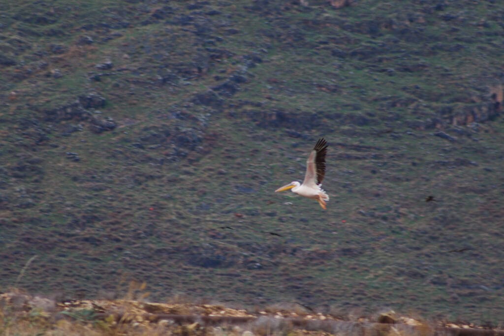
Full of excitement, we got out to take a look at the birds. We had never seen anything like it before in Israel: several types of large birds circled above us in the sky, dipping and gliding in the wind. I wished like anything that I had listened more closely to my mother, who always knows the name of every bird she sees. Instead, I only gaped in awe at the one bird I was certain I had never seen before in Israel: The Pelican, Lousiana’s State bird.
We were reluctant to pull ourselves away from this sight. But we had a long trail to cover on a short fall day. It was time to get going.
Not for the Birds
The next unusual sight of the day was fish: they were scattered in random spots on the trail. My husband suggested that perhaps, they had been dropped from the beaks of all the birds as they flew above.

Soon, we reached Ein Moda at Park HaMaayanot, a gorgeous area with pools of water. We dipped our hands in to check the temperature: the water was as warm as a bath. But there was nobody swimming on that chilly November morning.
We continued past the park and out into open fields, following the Emek HaMaayanot trail. This part of the walk shouldn’t have taken long, but again, the birds distracted us.
Birds in the fields lined up, resting. There were birds overhead, swooping through the trees. As we walked along one asphalt path, we saw a giant bird right in the middle. We got closer and he flew to the side of the path, but no further.

This poor little falcon (at least I think it was a falcon? Mama?) lay injured, unable to fly! We reported him to the Parks Authority and without any further ado, continued on our way.
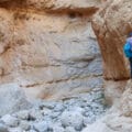
Caves and Mountains
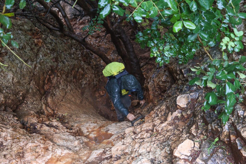
Soon, we reached the beginning of our uphill ascent. It was pretty late in the morning, so we decided to stop under a cluster of trees for coffee. The sun was now covered in fog. The clouds gave way to a light drizzle – we needed the shelter of the trees to keep our coffee dry.

After sitting there for a minute or two, the rain began to intensify. Luckily, just across the path, we spotted a little cave. We climbed over into its dry interior and finished our coffee, while watching the rain pour down.
The Ascent
Once we were thoroughly warmed by our coffee and muffins, we were ready to tackle the ascent. It was supposed to be tough, but I wasn’t worried: mountain climbing is one of my favorite things!
What I did not expect was the added difficulty of climbing in a rainstorm. We negotiated rocks, hand hold ladders, and mud, working our way slowly up the mountain.
I kind of wished that it hadn’t been raining. Through the fog, I could see an area of rich natural beauty, with thick trees and greenery. Instead of taking in my surroundings, I focused on the task at hand: not sinking in pools of mud as I tried to grip and propel myself upwards.
On the other hand, we did get to see the ravine filled with a raging stream.
At long last, we reached the top of the mountain. We were cold and wet, and ready for some easier walking.
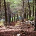
Forests, Windmills, and a Lookout
Luckily, we got it. The path veered left, and we ambled through a beautiful woodland. It was pretty magical in the fog. But through the trees, we got a taste of the incredible views from the top of the mountain: rolling plains and sectioned off farmland, under a wide open sky. We could tell that the view must be jaw dropping on a sunny day.

After a long walk in the forest, we climbed up towards the highway. The wind intensified, chilling us to the bone (wet+ wind = freezing cold!). We walked along the highway, past a series of well-placed windmills, eager to reach the lookout up ahead.
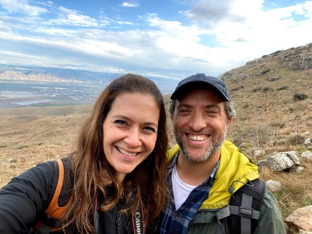
And then we were there: at a truly beautiful viewpoint atop the Gilboa mountains.

Just as before, the incredible views were clouded by the fog. Still, we appreciated just how amazing they would otherwise be. After pausing for a few minutes at the lookout, we were on our way.
The Essence of Gilboa
As we made our way down the other side of the mountain, we experienced true Gilboa scenery: a cluster of cows huddled under a wide canopied tree for protection from the rain.

Mother cows and their calves squeezed tightly together, babies drinking warm milk as they stood there. The pastoral scene was unexpected on a hiking trail.
As we proceeded, more cows appeared on the green hills. Little clouds of fog hung at different spots in the sky – some above, and some just below us. In the distance, we saw the green valleys and farmland as before. But now, we were in a spot where the sun shone just above the patches of fog.

I was brought back to our time spent in Ireland, where scenery like this was quite common. We paused for lunch and sat on a rock, taking in the Gilboa’s magical beauty.
Where the Fun Doesn’t Stop
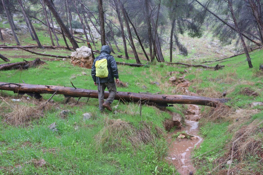
The next part of the trail was all downhill. At first, it seemed like the scenery on the way down would be quite different than it had been on the ascent: there was lots of greenery and an open feeling to this trail.
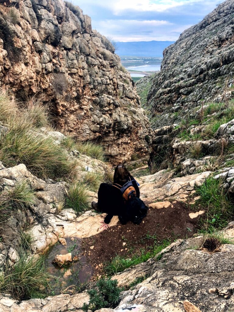
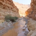
As we descended, the scenery began to change. We were now hiking through a sort of canyon, with strategically placed handhold ladders allowing us to climb down rocks in one piece.
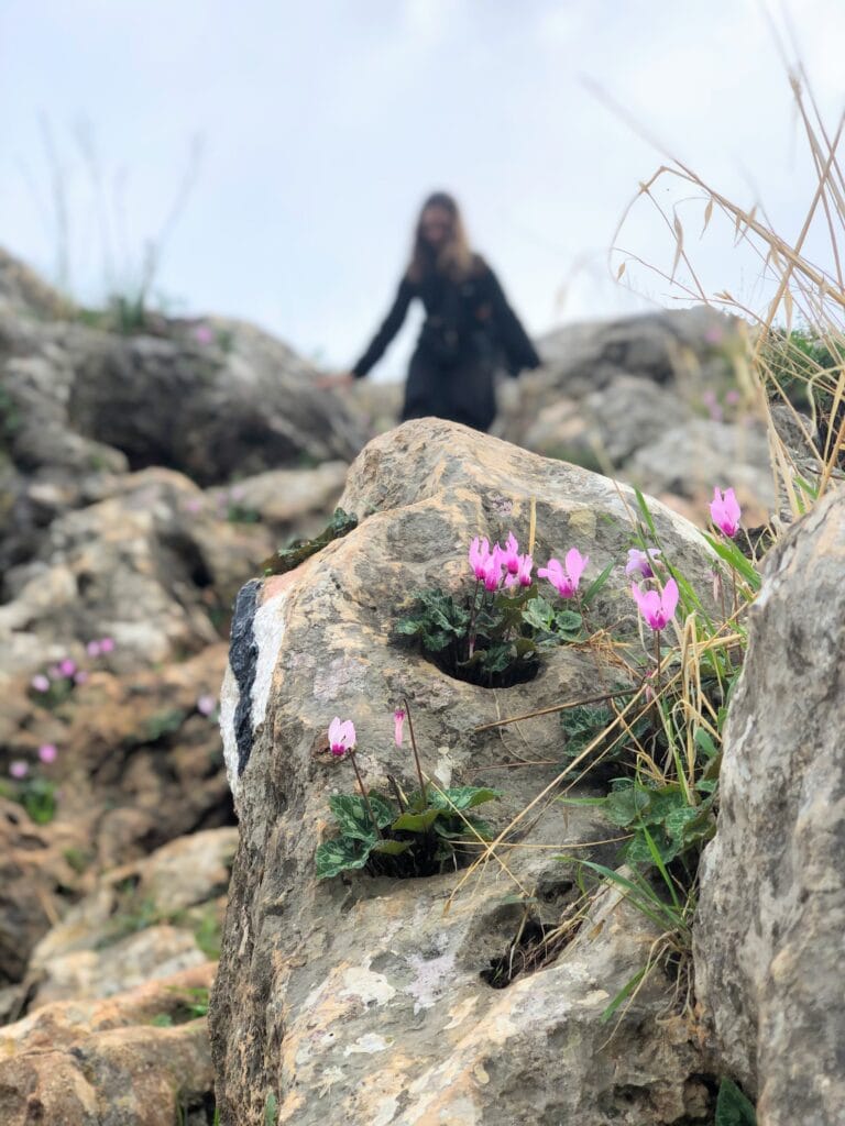
Between the boulders, cyclamen and narcissus grew in abundance. In the distance, through a crack in the rocks, we caught a glimpse of Emek HaMaayanot.
Just as before, the descent was somewhat treacherous on a rainy day. We carefully made our way down, doing our best not to slip and fall along the way. On a dry day, it would have been my favorite type of trail to tackle.
Home Free
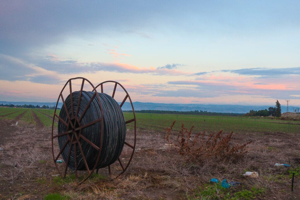
We reached the bottom close to sunset. The terrain had taken on an otherworldly glow. Pink clouds dappled the purple sky. The birds had mostly gone – only a few flocks still swirled in the sky.
Once again, the incredible scenery all around us touched our souls. At sunset, this area at the foot of the Gilboa looked like paradise. I wished that my camera lenses weren’t fogged up by the rain so I could do justice to the scene.
Instead, we just walked, passing fish farms, birds, and golden grain blowing in the wind. The Emek HaMaayanot scenery at 4:30 PM on a rainy November afternoon will stay in my heart forever.
And then, we were back at the car, just as night began to fall. Despite the rain, it had been a wonderful day. We had seen and experienced the beauty of nature in a way that we don’t get to every day.
This trek in the Gilboa Mountains covers only a fraction of the mountain ridge. But it gave us a taste of all of the incredibly beautiful nature that this part of Israel has to offer.

Hikers’ Notes:
Here’s what you need to know to hike this trail through the Gilboa Mountains:
- Best suited to fall, winter, and spring. This area can be very hot and dry in the summertime. This hike is not for rainy days (or even the days just after a rain).
- Not necessarily suitable for dogs – there are many spots where you’ll need to climb ladders.
- Wear hiking shoes with a strong grip. Bring plenty of water and a hat. The trail is a mix of sun and shade. If you have binoculars, you may want to bring them along – the bird life here is really spectacular.
- This area is a great spot for flower peeping later on in the winter. We’ll go back and keep you posted.
- Park HaMa’ayanot would be a great place to visit on its own, especially with kids. No need to add a 15K hike to enjoy the warm water and nature right around the trailhead.
- To follow the trail, study the trail map and trail marker gallery thoroughly. Do not rely only on the trail marker gallery: this trail is too confusing to understand with just the gallery. Use a combo of all of our navigational features to ensure that you stay (mostly :)) on the trail. Use the Google Earth link in the table at the top to follow your location along the trail.
Trail map from Amud Anan.
Don’t forget to read my guide to the navigational features in this post before you hit the trail.
Questions? Have you hiked this trail through the Gilboa Mountains? Let’s hear about it in the comments below!


I’m so excited to do this trail with my family. However we can’t do a a full 15 km. So I will just do the ascent and turn around. So we would skip the descent and the iron ladders part. Does the ascent you did have a lot of iron ladders? We love those and I don’t want to miss them
There are a few iron ladders, but not too many. If I remember correctly, they are all on the way up 🙂
This trail was awesome! Really great rock scrambling, ladders, rock slides and an amaaaaaaaazing cliff ledge. We just went up to the Shamir lookout (the top) and turned around there so it was only 6 miles instead of 9. Then swimming in Ein Hod! Thanks so much for introducing this awesome trail to us.