
| Trail Map | Terrain View | |
| Distance: 4km | Time: 2 hours | Difficulty: Moderate |
| Ascent: 109m |
Click here to go straight to hike notes.
One could hike for days around the Ramon Crater. Eight of them, to be precise.
Big adventures await along an eight-day loop trail that encircles Maktesh Ramon in the Negev. And that’s not the only challenging hike to be found in this massive erosion crater. There are long hikes up to the Shen (Tooth in English) and advanced hikes up mountains and through stream beds.
But there are easy hikes within the crater too. It doesn’t take a lot of effort to experience the incredible, otherworldly beauty of Maktesh Ramon.
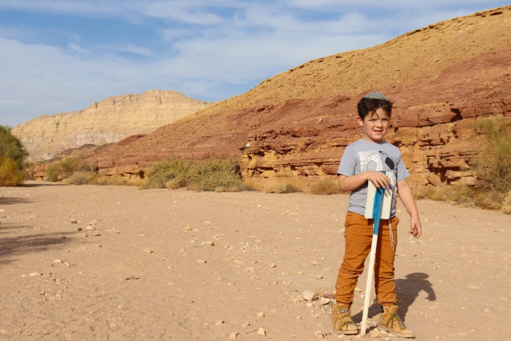
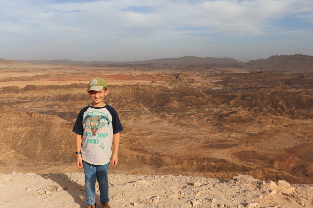
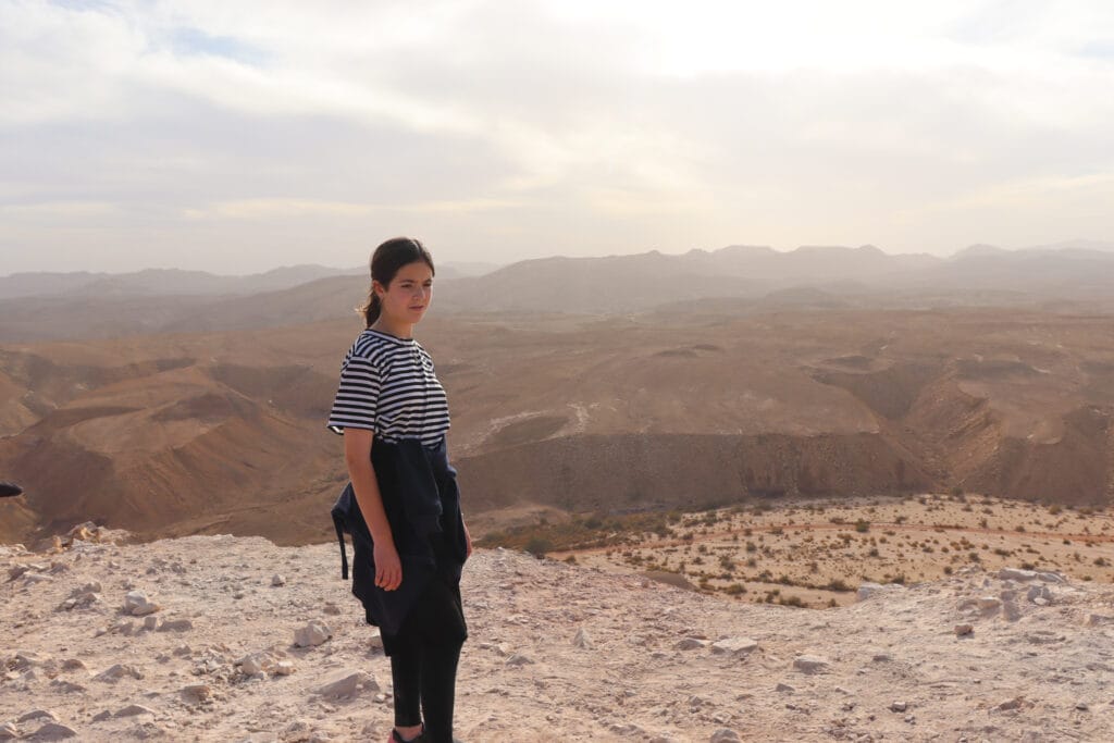
Last week, we visited Ramon Crater with our kids. It was the end of Hanukkah vacation, and everyone needed some chill time. Luckily for us, there was a moderate, family friendly trail in the crater that we had yet to try out.

After a slow morning, we embarked upon the 4 kilometer loop trail at Ramat Saharonim in the early afternoon hours. The trail would take us up to Harut Hill, with the option of climbing the hill for even more spectacular views. After that, we would head back down the hill and walk through the beautiful and unusual scenery in Nahal Ardon.
This loop trail was spectacular. True, it wasn’t difficult. But with the climb up Harut Hill, there was enough of a challenge to make everyone feel like they had accomplished something big. And the scenery along the way was breathtaking.
Here’s how we took this 4 kilometer loop trail to Givat Harut and Nahal Ardon in the Ramon Crater:
Pretty Pretty
After a long drive into the crater from Mitzpe Ramon, we pulled into the parking lot. The trail markers at the start looked familiar: we had been to this spot before. Several different trails lead out from this one parking lot.
We found the black marked trail towards Harut Hill and were on our way. Perhaps it was the time of day or the time of year, but even the very beginning of this walk was exceptionally pretty. The colors of the crater were bold and beautiful, and we were looking forward to exploring it more deeply.
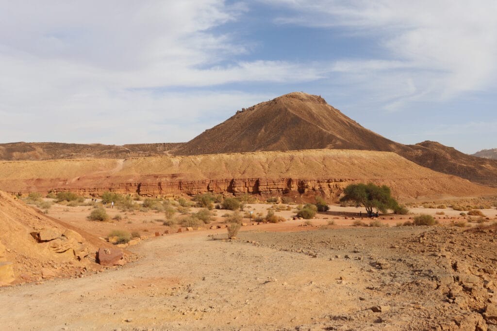
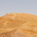
In the distance, we could see Harut Hill. It looked more like a looming mountain from our perspective down below. And the jury was still out on whether or not we would have time to climb to the top.
Onward to the Blue Trail
After a while, we reached a tree covered spot and a crossroads. We broke left to follow the blue painted trail markers towards Harut Hill.
We were now walking through what is known as Ramat Saharonim, or Saharonim Plateau. In this flat part of Ramon Crater, we could see colorful mountains and hills all around us. Up ahead, Harut Hill was clearly defined, along with the narrow pathway that made its way all around.
I was eager to see what the scenery of the Makhtesh looked like from above.
On the Climb
Soon, we were on the climb. As we ascended, some of my kids asked if this was the breakaway trail which would take us to the very top of the hill. I reassured them that we still had plenty to climb if we wanted to reach the top!
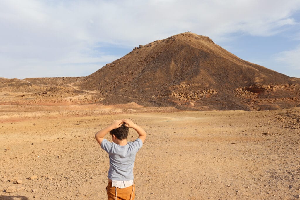
We reached a flat part near the middle of the hill, and then we saw the green trail. The narrow pathway climbed right up the mountain, in a relatively straight line. We had completed the first part of this hike with ease – we still had plenty of time to make the climb to the top of the hill.
So, up we went.
These Views!
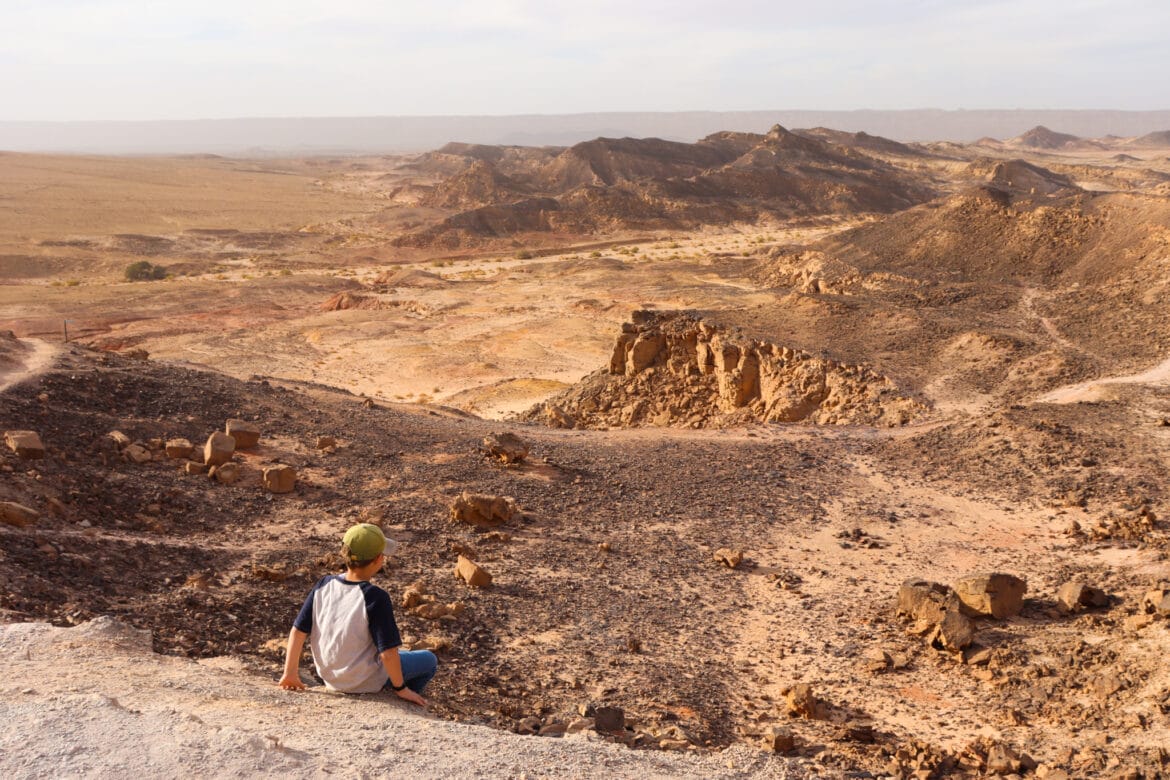
And it was so worth it. The views from the top of Harut Hill were simply incredible. On one side, jagged rocks jutted out from the terrain in a Mars-like landscape. On the other, a picture perfect, cloud-filled blue sky framed waves of color and stone plateaus.
I’ll never get used to the scenery in Ramon Crater. As the largest erosion crater on the planet, it does feel massive. So massive, in fact, that from within, it’s hard to know that you are even inside a crater. The only evidence to the crater’s existence is the endless expanse of very unusual looking rock layers all around.
We stood up there at the tippy top of a hill, taking in the views. Then we climbed back down the steep path to the flat part below.

Even at that altitude, the scenery was pretty impressive. Before continuing along the trail, we stopped to contemplate the Ramon Crater for a while, from our perch in the middle of a hill.
Into the Nahal
Next, we climbed down Harut Hill towards Nahal Ardon. At the bottom, we made a right to head back into the Saharonim Plateau.
We saw lots of interesting things on the way back. There were piles of perfectly flat rocks, stacked to form super tall cairns. My kids almost toppled them as they tried to stack a few more on top, but we were able to keep them (mostly) intact.

Then we passed ridges of colorful rock, in shades of green, red, yellow, and purple. It looked like a piece had been cut from a giant, colorful layer cake of stone.
As we walked through the valley, we could see Mount Ardon in the distance. We fondly remembered our last trip to the crater when we climbed to the top of that incredibly steep mountain. Perhaps we would hike it again on our next trip.
The Stuff Dreams are Made Of
For the rest of our hike, the scenery was simply captivating. The kids ran around from one hill of rock to the next. We followed the path through the valley past low acacia trees, shrubbery, and beautiful layers of rock. We passed Ein Ardon, identifiable only by the green reeds that grew out of one spot. And after a long and beautiful walk in nature, we were back at the trailhead.
Our hike that day up Harut Hill and through the Saharonim Plateau had been just perfect. This easy, circular hike offers the very best of Ramon Crater in one family-friendly trail.


Hikers’ Notes:
Here’s what you need to know to hike this trail to Harut Hill in the Ramon Crater:
- This trail is well suited to cooler days in fall, winter, and spring.
- This is a circular trail.
- This is a family-friendly trail.
- Wear good walking shoes, a hat, and bring plenty of water to hike this trail.
- To follow this trail: First follow the black trail. When you reach the crossroads, turn left to follow the blue trail. From the blue trail, get onto the red trail. You can make a detour on the green trail up to the top of Harut Hill and back down. Continue on the red trail until you reach the black trail. Make a right to follow the black trail back to the parking lot.
- Use the trail marker gallery and the trail map in the table up top to find your way.
- Ein Ardon (Ardon Spring) is along the last stretch of black trail. See if you can find it!
Don’t forget to read my guide to the navigational features in this post before you hit the trail!
Trail map from Amud Anan.


Hi Susannah!
Made that hike today with my husband (I’m 7months pregnant) and it was perfect! Not too long but we still saw beautiful landscapes!
Thank you so much! Your explanations were great, no need for google earth.