| Trail Map | Terrain View | |
| Distance: 4-9 km | Time: 2-4 hours | Difficulty: Moderate - Strenuous |
| Ascent: up to 287m |
Click here to go straight to hike notes.
Fall is here. Along with this season comes cooler days, migrating birds, and autumn wildflowers. It’s a wonderful time of year.
But autumn can be a somewhat problematic season for hiking. Some days are cool and pleasant, but others are hot. After a long, dry season, the natural terrain in Israel is not at its best. So, on hot autumn days, I try to stick to forested trails, caves, and water hikes.
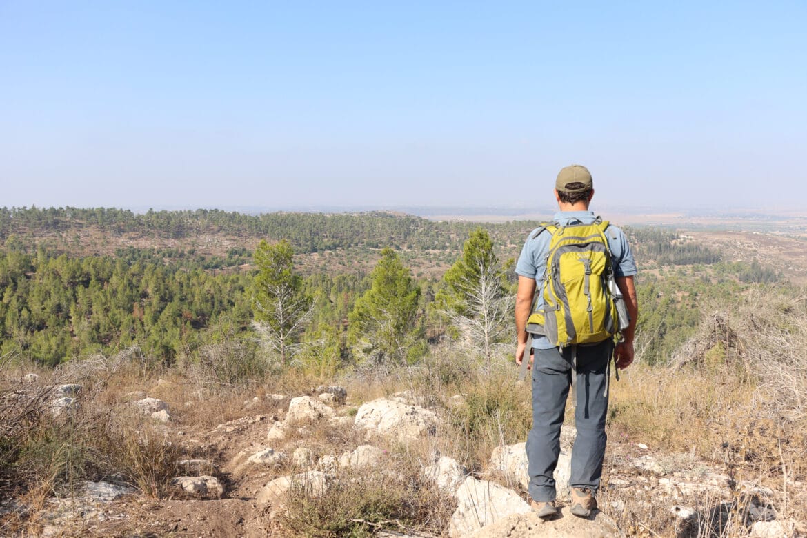
One morning last week, we scoped out a new trail in an old familiar place: Tzora Forest. The trail we chose led to the top of Mount Tnufa, towards what was said to be a gorgeous, panoramic lookout to the surrounding area.

Since my husband and I were on our own that day, we were looking for something a bit more strenuous than an easy walk to a mountain lookout and back. So, we decided to make it circular, turning our mountain view trail into a 9-kilometer journey back down Mount Tnufa, towards the village of Kfar Uria, and up through Tzora Forest. On the map, I could see that there were some points of interest along the way (an old burial cave, a destroyed village), so it seemed like the hike would be interesting as well as pretty.
As it turned out, this trail was wonderful, but different than we expected it to be. Here’s what we discovered on our hike to the top of Mount Tnufa and beyond:
“Climbing” a Mountain
After a short struggle with Waze (which wanted to bring us down a road that was more bumps than flat places), we arrived at the trailhead. We parked on the side, strapped on our packs, and headed down the black trail.
It was a beautiful morning. As is typical of Tzora Forest, a rich pine scent filled the air. I breathed in deeply, eagerly looking forward to our adventure in a quiet woodland. After a minute or two of walking, we made a right onto the blue trail, and began a mild ascent to the top of Mount Tnufa.

This trail wasn’t at all what I expected it to be. The surrounding area was beautiful. But rather than a steep climb to an isolated mountain peak, we ascended only slightly. And we were not alone. Several dirt bikes whizzed by as we walked, leaving behind dust and the smell of motor oil.
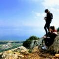
After walking a couple of kilometers, we reached the top of Mount Tnufa, along with a gorgeous lookout to picturesque surroundings.
On Top of Old Smokey
This place had it all: pretty lookouts, cute wooden picnic tables, and shaded benches facing the views. There was a little walking trail too, which snaked around the top of the peak. In short, Mount Tnufa looked like a fabulous place to go watch the sunset. We imagined climbing up here with our kids, setting up a picnic dinner, and enjoying the view as sunlight faded into night.

But it seemed that we weren’t the only ones in pursuit of a killer view (at least on a Friday). That day, there were several small groups of people at the top of Mount Tnufa. Some were quietly chatting over croissants and coffee, while others were loudly revving their motor bikes as they got ready to hightail it down the hill.
We took a few pictures at the top, then set off down the mountain, in search of a more serene place to stop for coffee.
Another Shady Lookout
Luckily for us, picnic benches are simply not a requirement for coffee. I much prefer a large flat rock in the shade of a tree. Just a bit further down the mountain, we found what we were looking for: a rocky area nestled in the pine trees. Just past the forest, we had a view of the valley beneath. It was a great place to stop.

We pulled out our iced coffee and cooled down, happy to be away from the noise and commotion that we had experienced moments earlier. All was peaceful, and we could once again savor the silence, the cool breeze, and the sound of the wind in the pine trees.
Off-Roading It
After our break, we got ready for the hard part of the hike: down the mountain towards Kfar Uriah and back up again. The first part of this trail was not marked, but it was fairly straightforward. We followed a steep path downward until we reached the black trail in the valley.
We walked out of the forest, towards large, dry fields, brown and crumbling in the early fall heat. Knowing this area well, I was aware of just how beautiful this place must be in the winter and spring. I could just imagine the lush greenery, the colorful flowers, the dramatic and cloud filled sky. This trail would have been absolutely perfect for the rainy season.

After passing by the fields, we reached an area full of carob trees, green and beautiful even in early autumn. Asparagus plants grew underneath each tree (and between them in large bunches). Again, I thought about the bounty I could collect on this trail in just a few months, when the plants would send forth young asparagus shoots.
For now, we continued on our way, beginning our ascent up the black trail and back through the forest.
Sights and Sounds in the Forest
This part of the trail was probably the most interesting. As we ascended, we could once more see down into the valley below. There was a little farm down there, along with olive orchards and goat pens. In the distance, we could see two reservoirs, gleaming in the morning sun.

To our left was a gorgeous forest, sitting atop a rocky area that looked like ancient ruins. According to the map, there were burial caves just down the hill. We didn’t have time to go on a search, but we did really enjoy walking through this part of the woods, over old pine needles and broken branches under the shade of tall trees.
New Discoveries
After walking for a while through the forest, past a pretty picnic area, we reached the last, sunny stretch of black trail. Soon, we were back at the car.
Our trail that day may have been very different than we expected. But we were so happy to have discovered something new. As we got back into the car, we planned out sunset trips with the kids to the top of Mount Tnufa, and more explorations of the beautiful, shady forest at the end of the trail. We spoke of returning here in late winter, when the dry fields and forest floors would be thick with greenery and blossoms.
This place was a gem. After that day’s hike to Mount Tnufa and through Tzora Forest, we were happy to have a new area of natural beauty to return to again and again.


Hikers’ Notes:
Here’s what you need to know to hike this trail to Mount Tnufa:
- The full trail is ideally suited to cooler days in fall, winter, and spring.
- You can hike a shorter version of this trail. Walk up to the top of Mount Tnufa, enjoy the views and sunset, and then return the way you came. This would be about a 2 kilometer walk each way. This version is recommended for kids!
- The full trail is a circular hike.
- Suitable for dogs.
- Wear a hat and good hiking shoes and bring plenty of water to hike this trail. In the wintertime, expect there to be mud on the crossover trail and the black trail after Mount Tnufa.
- Fridays are popular days for dirt biking. Try this trail on a weekday for a quieter experience.
- This trail is not particularly well marked, but it is still fairly simple to follow. Follow the black trail until the first turnoff which is the blue trail (not marked, see trail marker gallery). Follow the blue trail to the top of Mount Tnufa. Then, consult the trail marker gallery to see which trail to follow down the mountain. Walk straight along an unmarked trail (use Google Earth file for assistance) until you reach the second turnoff to the black trail. Follow the black trail all the way back, keeping a close eye out for trail markers the entire time.
- There are three great spots to stop along this trail. The first is at Mount Tnufa, assuming it's relatively quiet. The second is down in the valley - there is a carob orchard and then a pretty swing overlooking a view (either of these is a great place to stop). The third is on the last third of the trail: there are many nice places to stop in the forested area along the black trail, some with picnic benches and beautiful views.
- Regarding driving there: If you use Waze, it may try to bring you on an impassable road. Just backtrack and follow a paved road towards Shimshon's Grave instead. It should reroute you the correct way.
Don’t forget to read my guide to the navigational features in this post before you hit the trail!
Trail map from Amud Anan.
Questions? Have you hike to Mount Tnufa and beyond? Let’s hear about it in the comments!