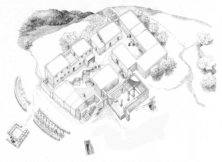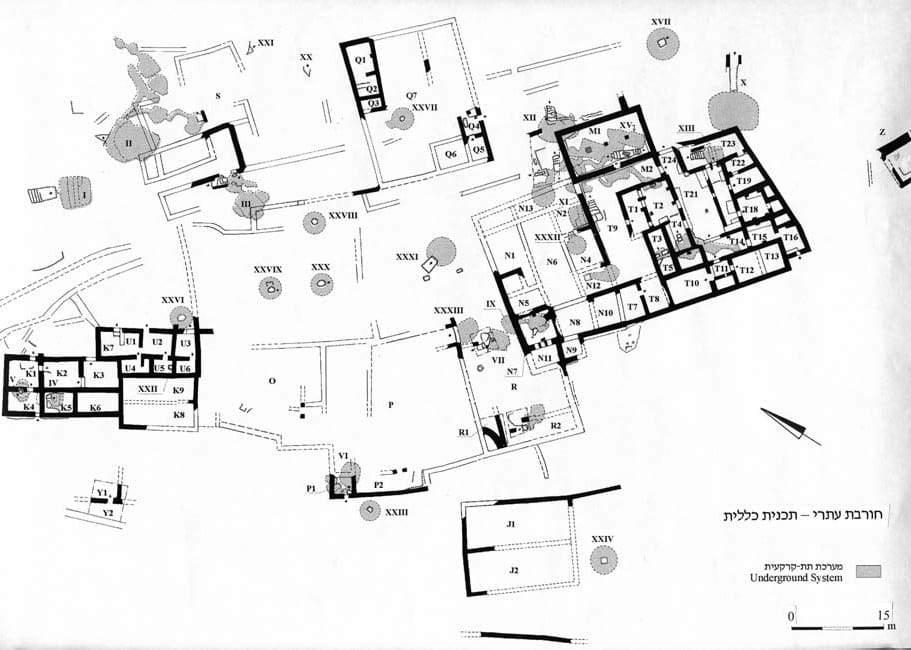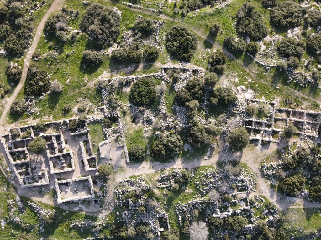
Public Building
A public building identified as a Synagogue.
It was built between the Great War and the Bar Kokhba Revolt.
When a person enters, they are facing Jerusalem.
Entrance to hiding complex
This was the location of the silver half shekel, some finds from the Jewish War and many artifacts from the Bar Kokhba Revolt.
Entrance to cistern
Hundreds of broken jars and cooking pots characteristic of the first century BCE.
Entrance to Mass Burial Mikvah
The skulls and bones of twelve individuals were found in this Mikvah. They included seven adults including men and women, four adolescents, and one fetus. At least one of the individuals had been beheaded.
Inner Court
רחובה של עיר
Hellenistic walls integrated into later structure
Rooms used as defense tower
Roman burial cave
Entrance to Hasmonean Mikvah